

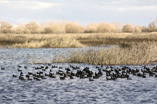
Sierra National Forest

PHOTO BY ADAM BLAUERT
National forests
Yosemite National Park is surrounded by national forest lands. To the northwest, the Stanislaus National Forest provides some of the closest mountain recreation for those of us in the Central Valley. On the opposite side of the Merced River, the Sierra National Forest provides equally close mountains.
When you drive to Yosemite on Highway 140 you are on the Sierra National Forest side of the river canyon for most of the journey. Directly across the water is Stanislaus National Forest.
McKinley Grove - PHOTO BY ADAM BLAUERT
McKinley Grove
The Park between Yosemite National Park and Kings Canyon National Park
The name “Sierra National Forest” can be confusing because the Sierra Nevada mountain range stretches all the way from Highway 36 east of Chico to Tehachapi Pass (Highway 58) in the south.
Sierra National Forest comprises only part of this area – specifically the area between Yosemite National Park and Kings Canyon National Park. Its 1.3 million acres of land provide just about every type of outdoor recreation imaginable. From dry foothills to snowbound windswept peaks it is a glorious place to explore.
Just as with its vast northern neighbor Stanislaus National Forest, the question “What do you do there?” requires a long answer. This article is an effort to answer that question and to provide a list of useful resources for learning about the forest and its recreational opportunities.
One of the best resources to start with is the annual visitor guide produced by Sierra National Forest
website: http://www.3forests.us/

Shaver Lake - PHOTO BY ADAM BLAUERT
Shaver Lake
Popular recreational activities within Sierra National Forest include
Auto touring
Staying in developed recreation areas within and near the forest
Hiking and backpacking in wilderness areas
Hiking trails outside of wilderness areas
Camping
Ranger-led activities
Fishing
Boating
Swimming
Hiking and camping with dogs
Horseback riding
Mountain biking
OHV riding and exploring 4-wheel drive roads
Hunting
Downhill skiing
Playing in the snow
Cross-country skiing and snowshoeing
Snowmobiling
Within the forest there are many privately owned areas. Some of these offer additional recreational opportunities plus tent and RV campgrounds, lodging, restaurants, stores, and gas stations.

Kaiser Pass Road View - PHOTO BY ADAM BLAUERT
Kaiser Pass Road View
Ranger Stations
The Sierra National Forest Headquarters is located at 1600 Tollhouse Road in Clovis. You can get general forest information and recreation permits by contacting the headquarters.
The phone number is (559) 297-0706 and the general website for the entire forest is www.fs.usda.gov/sierra/.
The forest is divided into districts which can provide more specific information about their respective areas
High Sierra District: 29688 Auberry Road, Prather –(559) 855-5355
Bass Lake District: 57003 Road 225, North Fork – (559) 877-2218
Yosemite Sierra Visitor Bureau: 41969 Highway 41, Oakhurst – (559) 683-4636
Mariposa Interagency Visitor Center: 5158 Highway 140, Mariposa –
(209) 966-7081
Eastwood (seasonal): Highway 168 and Kaiser Pass Road, Huntington Lake –
(559) 893-6611
Dinkey Creek (seasonal): Dinkey Creek Road at Dinkey Creek – (559) 841-3404
High Sierra (seasonal): Kaiser Pass Road – (559) 877-7173

Ansel Adams Wilderness - PHOTO BY ADAM BLAUERT
Ansel Adams Wilderness
Road Access and Auto Touring
Unlike the national forests to the north, no road crosses the entire mountain range within Sierra National Forest. Highway 168, the major state highway in the area, penetrates deep into the mountains and the Kaiser Pass Road to Edison and Florence Lakes approaches the crest, but there is no automobile crossing. This leaves plenty of room for exploration on foot or horseback.
A number of secondary roads ranging from two-lane paved roads to rough four-wheel drive roads provide plenty of additional access. Besides Highway 168 and Kaiser Pass Road, the paved roads to Courtright and Wishon Reservoirs are great scenic drives.
The partially-paved 100-mile Sierra Vista Scenic Byway is also a great choice for auto touring. Usually the road can be traversed by any car if driven carefully, but high-clearance is recommended.
For more information about the byway go to www.sierravistascenicbyway.org/
Major Towns, Supplies, Lodging, Food, and Gas
The major supply and service locations are adjacent to the major roads. Each of the major routes has chambers of commerce and/or business associations with websites for information about lodging, food, supplies, gas, local activities, and special events.
I’ve listed them below in order from north to south:
Highway 140 ~ Mariposa, El Portal
Highway 41 ~ Oakhurst, Sugar Pine, Fish Camp
Sierra Vista Scenic Byway ~ Bass Lake, North Fork, South Fork
Highway 168 and Kaiser Pass ~ Shaver Lake, Huntington Lake, Edison Lake

Courtright Reservoir - PHOTO BY ADAM BLAUERT
Wilderness Areas
Five wilderness areas are within or partly within the boundaries of Sierra National Forest. They offer some of California’s best hiking, backpacking, and fishing. They are also great places to enjoy abundant and brilliant wildflowers and to see a variety of wildlife in its natural habitat.
Ansel Adams Wilderness
Named for the photographer whose timeless images turned the Sierra Nevada’s striking landscapes into universally-recognized icons, this great wilderness area makes up much of the northeastern section of Sierra National Forest. With stunning mountain peaks, alpine lakes, and the headwaters of the San Joaquin River, the Ansel Adams Wilderness has a lifetime of trails to explore.
Dinkey Lakes Wilderness
One of the smaller wilderness areas in the forest, this often-overlooked region has many lakes and surprisingly easy day hike and backpacking destinations.

Dinkey Lakes Wilderness - PHOTO BY ADAM BLAUERT
Dinkey Lakes Wilderness
Note: the lakes are not “dinkey” in size; the wilderness was named for a dog named Dinkey who saved a pioneer from a grizzly bear attack.
John Muir Wilderness
The protection of the Sierra Nevada Mountains is largely due to the work of naturalist John Muir and it is only fitting that one of the largest wilderness areas in the range bears his name.
The eastern part of the wilderness is part of Inyo National Forest. This area contains some of the highest peaks in the lower 48 states, glaciers, an amazing number of lakes, and excellent fishing.
Kaiser Wilderness
This is a small wilderness area that is largely unknown outside the Fresno area. Centered around Kaiser Peak and north of Huntington Lake, the area contains several small lakes. Trails are generally more challenging than the equally-sized Dinkey Lakes Wilderness.
Monarch Wilderness
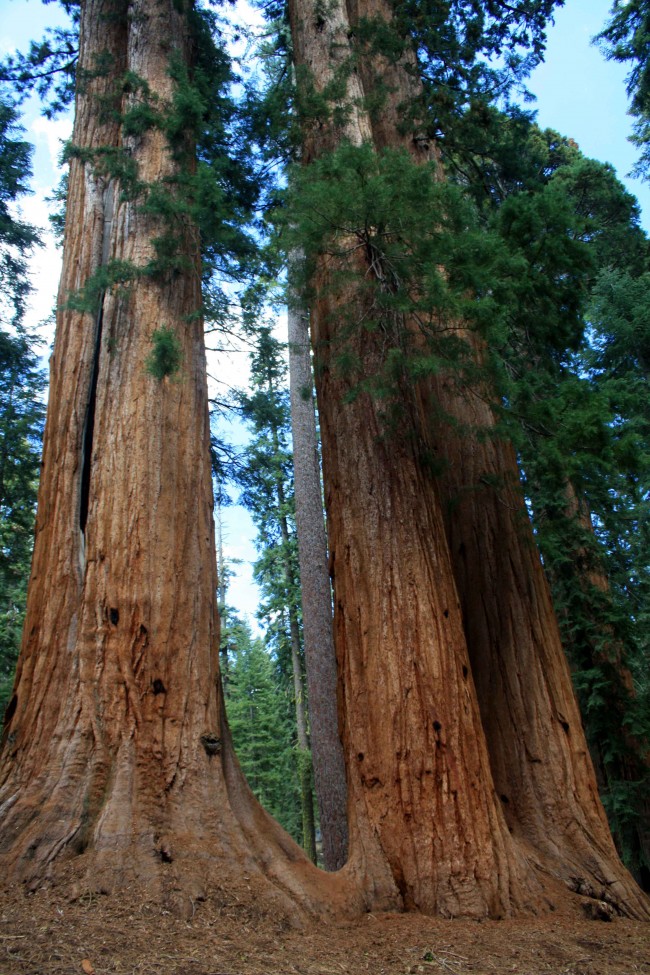
At the southernmost edge of Sierra National Forest, this small and almost unknown wilderness is mostly located within Sequoia National Forest and the Giant Sequoia National Monument. Although it lacks lakes and contains some extremely rugged terrain it is a place where solitude is likely to be found among old growth giant sequoias.
Trails Outside of Wilderness Areas
A number of excellent trails are found outside of the wilderness areas. Details can be found in some of the books listed below. Some of the most popular non-wilderness trails are within the forest’s two groves of giant sequoias:
Nelder Grove
On the northern edge of the forest north of Oakhurst, this partially-logged grove still has several impressive trees.
For more information go to: http://www.neldergrove.org/
McKinley Grove
Located along the McKinley Grove Road between Dinkey Creek and Wishon Reservoir. An easy walk through the trees is a trail that is within just about anyone’s ability range.
For more information go to: www.fs.usda.gov/Internet/FSE_DOCUMENTS/stelprdb5344073.pdf
Books, Maps, and Other Resources
Although web-based resources are great for planning a trip, cellular service, internet, and electric power are hard to come by in much of the forest.
If you can store electronic resources on your device and have well-charged batteries, you may be able to continue to access your information this way. It’s always good, however, to have some paper resources.
Print out information from the internet and bring both maps and books. The general guide produced by Sierra National Forest is invaluable to have with you, especially if your plans change while on a trip.
Weather and other elements outside of your control often require flexibility.
You can access and print that guide here: www.3forests.us/sierra
Books
Unfortunately there is no single book that comprehensively covers this area. For backpacking, Sierra South from Wilderness Press is a great choice.
For shorter day hikes, pick up a copy of California Hiking by Stienstra and Brown. Not only does this book highlight the best day hikes in Sierra National Forest, it is also an excellent resource for the entire state with a total of 1,000 hike routes.
Hiking the Sierra Nevada by Barry Parr is also a good choice.
Maps
It’s good to have a general highway map, but if you plan to explore off the main roads the Sierra National Forest Map is one of the most important things to have with you.
In addition to roads and trails, it also shows campgrounds, ranger stations, supply locations, and recreation areas. It supplements the general guide to the forest (see above).
You can buy it from the U.S. Geological Survey for $12: store.usgs.gov from a variety of other online retailers. You can also purchase it at a ranger station.
For hiking or backpacking, the following maps are the top choices: No matter what resources you use, always call a ranger station to verify current conditions before you leave on a trip. Conditions are always changing and even the official websites can be badly out of date.
Ansel Adams Wilderness published by Tom Harrison Maps
(I generally prefer Tom Harrison’s maps because they have the mileage directly written on each trail segment – this makes for easier trip planning. They are also waterproof).
Dinkey Lakes Wilderness published by Tom Harrison Maps
Mono Divide High Country Trail Map published by Tom Harrison (covers most of the John Muir Wilderness)
A Guide to the Kaiser Wilderness published by the US Forest Service
For more detailed hiking maps, check the USGS website for 7.5 and 15 minute sections.
You can order printed copies of these maps or download free electronic copies.

Edison Lake - PHOTO BY ADAM BLAUERT
Edison Lake
Campground Camping
Within Sierra National Forest you’ll find 82 campgrounds.
Most are detailed in the forest guide: www.3forests.us/sierra
Some campgrounds are reservable in advance. You can search for reservable campsites by going to: www.recreation.gov.
Dispersed Camping
Camping outside a campground (usually referred to as “dispersed camping”) is permitted in areas of the forest where signs do not specifically prohibit it.
You can always check with a ranger station before you set up camp. In order to have a campfire you need a California Campfire Permit, available at any ranger station.
You can also take an online quiz and get one issued electronically by going to:
http://www.fs.usda.gov/sequoia/
As long as you follow the rules on the permit and make sure that you have chosen a safe site, your campfire is legal. Before your trip you should also make sure that additional campfire restrictions have not been put in place.
In dry years campfires are sometimes prohibited outside of established campgrounds. This year is no different and some limitations have been imposed.
Ranger-Led Activities
A variety of programs and hikes for all ages and ability levels are offered throughout the year. For current schedules call the ranger district that you plan to visit.
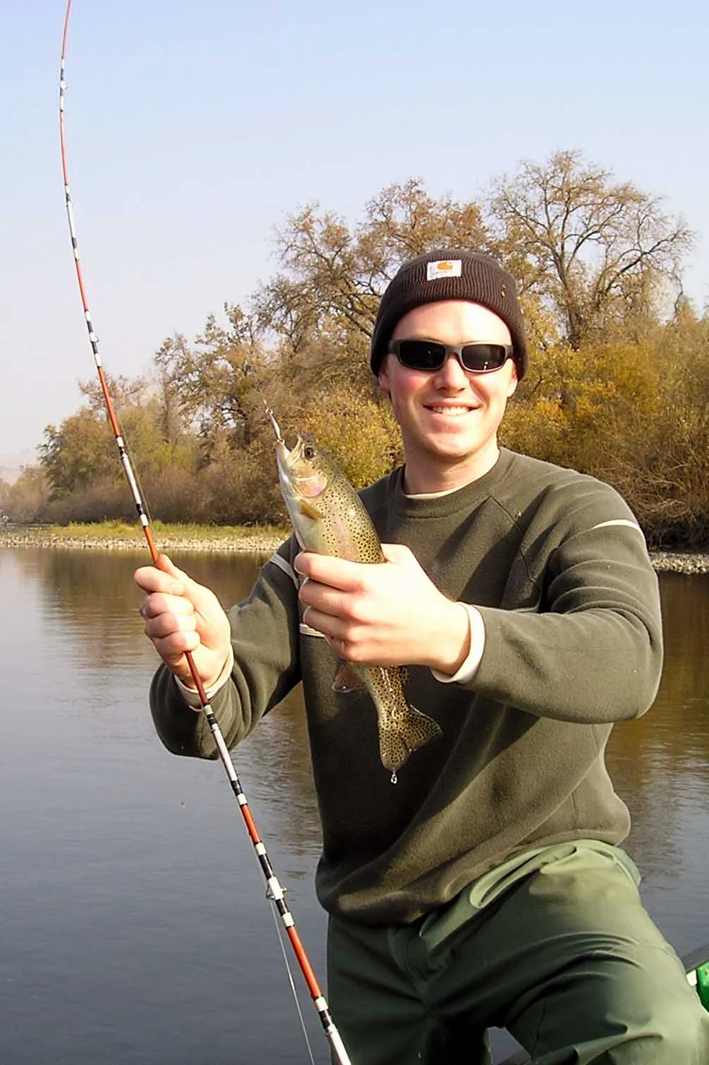
Fishing
The forest abounds with streams, rivers, natural lakes, and reservoirs. Many are stocked and most are open to fishing.
For regulations and stocking information, go to www.dfg.ca.gov. Tom Stienstra’s California Fishing is a good general guide to the whole state, including Sierra National Forest.
Boating
Motorized fishing boats area allowed on the following lakes: Bass, Courtright, Edison, Florence, Huntington, Mammoth Pool, Pine Flat, Redinger, Shaver, and Wishon. Water skiing and jet skis are allowed at Bass, Huntington, Pine Flat, Redinger, and Shaver.
Swimming
Swimming is allowed in most streams, rivers, and lakes, however it can be dangerous. Make sure that all people in your group have strong swimming abilities and you have flotation devices in case a rescue is necessary. Check with a ranger for current conditions and recommended areas.
Dogs
Dogs are welcome on trails and in campgrounds in national forests as long as they are on-leash and well-behaved. They are not permitted on trails in state or national parks. Dogs may be off-leash as long as they are under voice control within wilderness areas (except in bighorn sheep habitat areas – check with a ranger station if you are planning a backpacking trip with a dog).
Horses
Horses are permitted on trails within the national forest. For overnight trips they must be included on your wilderness permit. Check with the ranger station for the best trail parking for horse trailers. Day rides and overnight pack trips are offered by:
D&F Pack Station: http://dandfpackstation.squarespace.com/
High Sierra Pack Station: http://www.highsierrapackstations.com/index.html
Horse Corral Pack Station: http://www.highsierrapackers.org/horse.htm
Minarets Pack Station: http://www.highsierrapackers.org/min.htm
Muir Trail Ranch: http://www.muirtrailranch.com/horses.html
Shaver Lake Stables: http://www.shaverstable.com/
Yosemite Trails Pack Station: http://www.yosemitetrails.com/
If you are not up to carrying all your gear or if you want to enjoy the wilderness with in a less strenuous way, a pack trip is a good choice.
Mountain Bikes
All roads and most trails outside of wilderness areas are open to mountain bikes. Check with a ranger for recommended trails and roads.
Off-Highway Vehicles and 4-Wheel Drive Vehicles
Many remote forest roads require 4-wheel drive and several areas are open to off-highway vehicles.
A copy of the Sierra National Forest map is extremely helpful in locating the best sites.
Hunting
The forest, including wilderness areas, is open to hunting according to DFG regulations. You can check regulations at www.dfg.ca.gov. Target shooting is prohibited in wilderness areas.
Winter Activities
Some roads and campgrounds are open through the winter months, especially in the lower elevations. Always carry tire chains and know how to install them. Highways 41, 140, and 168 are open throughout the winter except for temporary snow closures.
Most other roads are closed. Many lodging facilities are open year-round.
Downhill skiing and snowboarding
Offered at China Peak on Highway 168 at Huntington Lake. For more information: www.skichinapeak.com/
Snow Play Areas
Sierra National Forest is also a popular destination to play in the snow. Five “Sno-Parks” offer snow recreation for a $5 use fee. Permits must be purchased before you reach the Sno-Park. Look for signs as you drive up Highway 168 or call the ranger station for a current listing.
Snowshoeing and cross-country skiing
Along trails is also popular. Occasionally ranger-led snow activities are offered. Check with the ranger station for details. If none are offered, try Yosemite or Sequoia National Parks.
To find your own route, pick up a copy of Best Snowshoe Trails of California by Mark White.
Snowmobile Trails
For snowmobiling information go to www.fs.usda.gov/detail/sierra/recreation/wintersports/?cid=stelprdb5303598
or call the ranger station.

Henderson Park

PHOTO BY ADAM BLAUERT
Henderson Park popular for picnics
Stretched along the bank of the Merced River in eastern Merced County, Henderson Park is shaded by tall trees and further back from the road than the facilities at Hagaman County Park or George J. Hatfield State Recreation Area.
Like McConnell State Recreation Area, it feels more distant and removed than it actually is.
The park is popular for picnicking, large gatherings, river recreation, and fishing. Three rental facilities are available, including an indoor clubhouse with kitchen and fireplace.
Although Merced County Parks and Recreation discourages swimming in county parks, swimming is not prohibited here. Warning signs are posted and any swimming you do is at your own risk.”
Location
Merced Falls Road, 1 mile east of Snelling Distance from Merced: 20 miles Distance from Los Banos: 55 miles
Facilities and activities
Flush restrooms
Drinking fountains
Picnic areas with tables, shelters, and BBQ grills
Group picnic/banquet facilities (indoor and outdoor)
Playground
Softball diamond
Horseshoe pits
Dogs allowed? No
Horses allowed? No
Hunting allowed? No
Fishing and boating
Fishing for rainbow trout is popular along the river and small boats can be hand launched from a concrete ramp (vehicles are not permitted near the ramp).
Nearby Parks: Camping is available at:

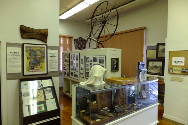
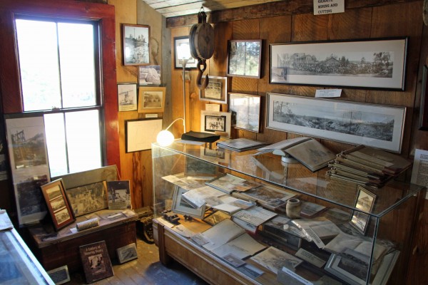
Livingston Historical Museum

photo by adam blauert
Livingston Historical Museum Foundation
On the northern edge of Merced County, the town of Livingston boasts an interesting historical museum.
It’s a great place to stop on a Sunday afternoon when it is staffed by members of the Livingston Historical Museum Foundation from 2 to 4 PM.
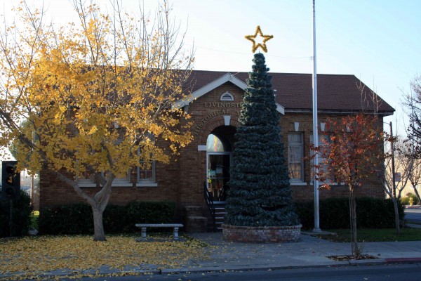
Museum at Christmas - PHOTO BY ADAM BLAUERT
Located on the corner of Main and C Streets in downtown Livingston, the museum’s collections are housed in a brick building that once served as the town’s city hall and courthouse.
David Livingstone
The town was named for Dr. David Livingstone, a British explorer of Africa who was an international celebrity in the late 1800’s. An error on the town’s Post Office application resulted in the difference in spelling between his name and the town’s.
Although the town’s original streets were laid out when the railroad arrived in the 1870’s, real growth began when irrigation water became available in the early 1900’s.
Like its neighbors Turlock, Hilmar, and Atwater, much of the settlement was accomplished through the colony system. Land speculators bought large tracts of land and then subdivided them and sold the subdivisions to farmers on credit.
These colony subdivisions were often marketed to specific ethnic groups through cultural networks and home-language periodicals. Best-known of these colonies was Yamato, settled by Japanese-Americans.
The museum has an excellent collection of photographs and artifacts from these early settlers. Their first years in the area were challenging, but hard work and determination ultimately led to success.
Internment camps
During WWII, prejudice and war hysteria led to the incarceration of 110,000 Japanese-Americans in internment camps throughout the western states. The museum has many examples of art created by the internees in the camps after they were forced to leave their homes.
One of the inspiring stories to come out of this sad time in our history is that of how the land and property of Livingston’s Japanese-American farmers was protected by a corporation formed by these farmers and placed under the control of a European-American lawyer.
Unlike most other Japanese-Americans, these farmers got most of their property back after they were released.
Wakami, Japan
You can learn more about this story at the museum. Fittingly, Livingston’s sister city is Wakami, Japan. The museum displays a collection of gifts from Wakami.
For more information about Japanese-American internment, you can also visit the Merced Assembly Center Memorial at the Merced County Fairgrounds.
4,669 Japanese-Americans from areas surrounding Merced and Livingston were held at the Merced Fairgrounds for five months before spending the remainder of the war at Amache, Colorado.
The story of the internment is told by plaques bearing the names of the internees, historical displays, and a sculpture.
This simple, highly effective sculpture depicts a young internee seated on a pile of suitcases awaiting an unknown and frightening future.

little-girl-japanese - PHOTO BY ADAM BLAUERT
Livingston has drawn people from around the globe. In addition to Japan, many of its residents and their ancestors have come from the Azores Islands, the Philippines, Mexico, and most recently, India.
The museum displays cultural artifacts from all of these groups.
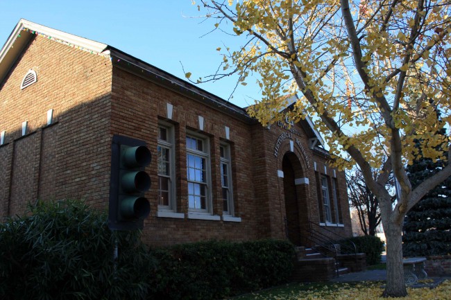
Museum and Stoplight - PHOTO BY ADAM BLAUERT
The famous stoplight
In front of the museum you can see the famous Livingston stoplight– the last remaining stoplight on the 275-mile stretch of Highway 99 south of Sacramento and the site of many accidents until community leaders finally convinced the state to rebuild the road as a modern freeway in 1997.
Photograph collection
As a teacher, I was especially interested in the collection of photographs of the original Livingston High School. Built in 1924, it was one of the first high schools in the county.
The photos depict how much education has changed since that time. Although Livingston is still a small town, it has seen a lot of change in the last 100 years. The Livingston Historical Museum does an excellent job of showing just how much change has occurred.
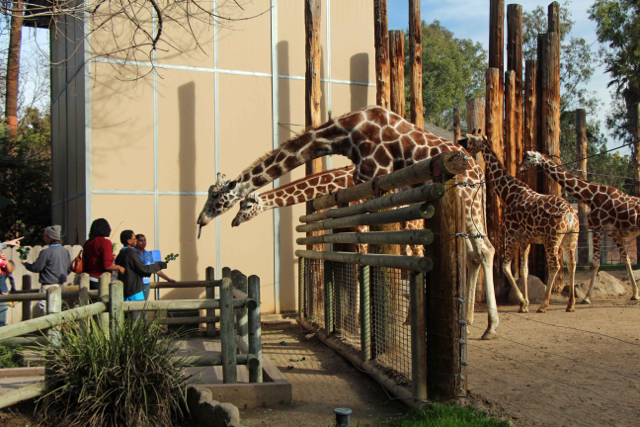
Fresno Chaffee Zoo

photo by adam blauert
Zoos in the Valley
The Applegate Zoo in Merced is the best place within a 100 mile drive where you are guaranteed to see a broad selection of local wildlife.
Fresno’s Chaffee Zoo is the best place with 100 miles to see a wide range of animals from around the world.

PHOTO BY ADAM BLAUERT
Fresno Zoo
An easy hour drive south from Merced, the zoo has so much to see that you’ll need half a day or more to enjoy all the exhibits. On our recent visit we spent 2 ½ hours and could have easily stayed longer if closing time hadn’t rolled around so quickly. Some highlight exhibits of the zoo include:
Large mammals: wolves, tigers, giraffes, gazelles, orangutans, zebras, Asian elephants, tapirs, camels, bears, warthogs, sea lions
Marsupials: kangaroo
Reptiles: Galapagos tortoises, alligators, a variety of snakes, and dozens of smaller species
Avian species: Andean condors, eagles, flamingos, emus, ostriches, black swans, and special aviaries devoted to African, Australian, and tropical species

PHOTO BY ADAM BLAUERT
Interactive Zoo
In addition to exhibits you can walk around and enjoy, the zoo is also interactive and includes:
Small Wonders Animal Encounters: a petting zoo where kids of all ages can enjoy gentle animals face-to-face.
Giraffe Feeding: For $2 a person, you can hand feed a giraffe. For $3 more you can get a professional quality photo of the feeding to take home.
Sea Lion Cove: The best recent addition to the zoo is this opportunity to view sea lions at four different levels. My favorite level is the underwater one. Looking into the sea lion pool through a large window, you can be at eye level with the sea lions as they swim towards the glass and interact with their visitors. I’m still not sure if it is more fun to watch the sea lions or to watch small children as they interact with the sea lions!
Dino Dig: Kids of all ages can participate in a simulated paleontological dig to recover a full-size tyrannosaurs rex.
Stingray Bay: For $2/person, you can touch cow-nose rays and southern stingrays.
Winged Wonders Bird Show: daily free-flight bird show presented during good weather from March through October.
Keeper Chats: Offered several times daily in many sections of the zoo, these presentations are a great way to learn more about the zoo’s animals from the people who take care of them.
Walk-Through Bird Enclosures: The Tropical Rain Forest, African Aviary, and Australian Aviary are places where you can walk among the birds and see them at extremely close range.

PHOTO BY ADAM BLAUERT
For current schedules for all of these activities, check the zoo’s website.
https://www.fresnochaffeezoo.org/
The zoo is open every day of the year except for December 25th. From April 1 through September 30, it is open from 9AM to 6PM. From October 1 through March 31 it is open from 9AM to 4PM.
On Thanksgiving Day it is open from 9AM to 2PM. Admission is $7 for all visitors aged 12 through 61 and $3.50 for seniors (62+) and children (2-11). Children under 2 are free.
The zoo has clean restrooms, a gift shop, and two food options if you get hungry during your visit (Safari Café and Nosara Grille).

PHOTO BY ADAM BLAUERT
No age limit to fun
No matter what your age, the zoo is a lot of fun. Strollers, wheelchairs, and other mobility devices are welcome. Wagons, strollers, and wheelchairs can also be rented once you arrive at the zoo.
If you’re a photographer, the zoo is a great place to bring your camera. If you hope to take photos for a purpose other than personal use, check with the Zoo’s Marketing Department first.
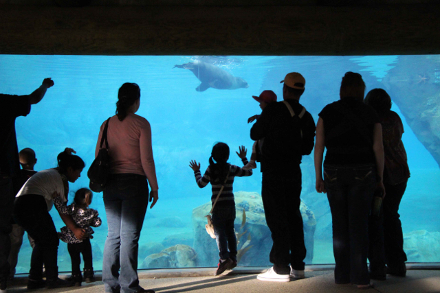
PHOTO BY ADAM BLAUERT
Sea Lion Cove was the zoo’s latest addition and ongoing work will bring a variety of new exhibits in the months to come. The next two projects will bring African Spotted-necked river otters and king cobras.
Located at 894 West Belmont Avenue in Fresno, it’s easy to find. From Highway 99, exit Belmont and turn left onto Belmont. Look for Roeding Park on your left and turn into the main entrance.
There is a $5 fee to enter the park, which includes your parking. The park can be crowded on weekends, so it’s a wise idea to arrive in the morning or to visit on a weekday.
For more information, go to https://www.fresnochaffeezoo.org/
or call (559) 498-5910.
Party Information
In addition to regular visitor hours, the zoo offers a Zoo Camp, family and group overnight events, twilight and backstage tours.
The zoo can also accommodate birthday parties and weddings. You can find more information and current schedules on the website.

George J. Hatfield Recreation Area

Photo by adam blauert
George J. Hatfield Recreation Area:
This state park has a mile of river frontage and plenty of shade. It’s proximity to the road and the poor condition of some of its facilities make it less favorable than some of the other parks on the river, but it still provides many excellent fishing opportunities.
Hatfield - PHOTO BY ADAM BLAUERT
Near the park is a historic bridge over the Merced River. Built in 1910, it is now open only to pedestrians and bikers. It provides nice views of the river.
Location: 4394 North Kelly Road, Hilmar, CA
Distance from Merced: 30 miles
Distance from Los Banos: 29 miles
Size: 46.5 acres
Hatfield Facilities and activities:
Flush restrooms
Drinking fountains
Campgrounds/group campgrounds with BBQ grills/fire rings
Picnic areas with tables, shelters, and BBQ grills
Group picnic areas
Swimming area
Dogs allowed? Yes
Horses allowed? No
Hunting allowed? No
Fishing or boating? Fishing can be good at George J. Hatfield Recreation Area. Rainbow trout and bass can be caught in the spring; catfish and perch throughout the year. No boating ramp is provided, but it is possible to swim in the river or to launch a float tube or hand-carried boat.
Website: Hatfield Recreation (click Here)
Nearby Parks: Undeveloped Great Valley Grasslands State Park has a six mile hiking trail.
Raymond Museum

photo by adam blauert
From 1886 until the completion of the Yosemite Valley Railroad in 1907, the closest you could get to Yosemite by rail was the town of Raymond in the foothills of Madera County. Far more comfortable than stagecoach, many visitors chose to take the train to Raymond in order to shorten their stagecoach ride. When President Teddy Roosevelt visited the park in 1905 to meet and camp with conservationist John Muir, this is the way he traveled.
Miller House and Caboose - PHOTO BY ADAM BLAUERT
Although the tracks are gone and most people have never heard of Raymond, the town still survives in the hills between Eastman and Hensley Lakes. Since 2008, it has boasted a great museum.
Miller House - PHOTO BY ADAM BLAUERT
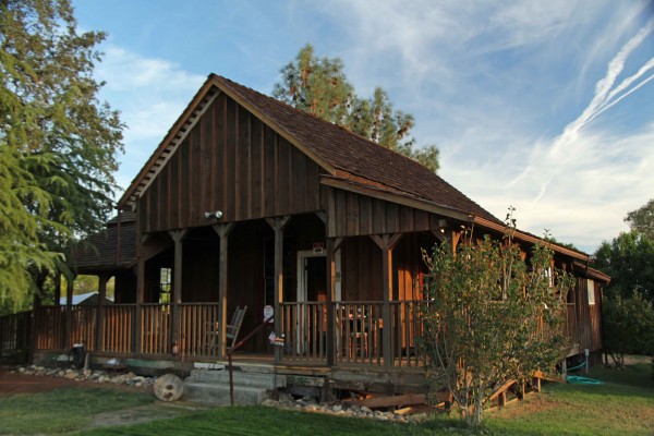
The Charles Miller House
The museum is located in the town’s first building – the Charles Miller House – built in 1886. What’s interesting about it is that it contains both the history of the town and a lot of information and photos of early travel to Yosemite.
The house is furnished to look the way it would have looked in the 1880’s – furnishings interspersed with extensive displays of historic photos and artifacts.

Wagon and Buggy - PHOTO BY ADAM BLAUERT
The nearby quarry at Knowles has provided “Sierra White” granite for many of the state’s greatest public buildings including the Los Angeles City Hall, the Campanile at UC Berkeley, and many of the civic buildings constructed in San Francisco after the 1906 earthquake.
The museum has a room devoted to Knowles and its quarry. Outside is a huge granite saw – the oldest in California.
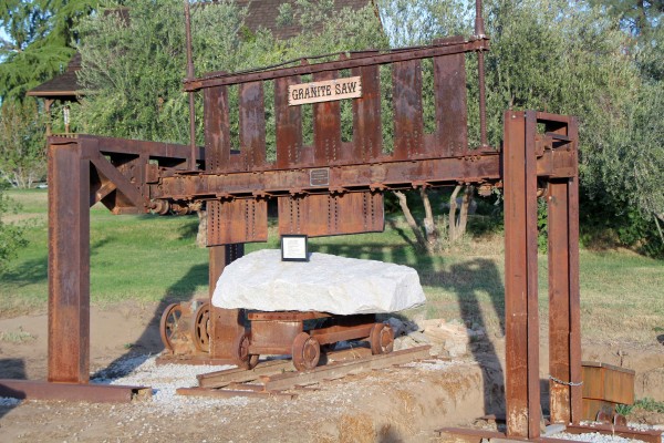
Granite Saw - PHOTO BY ADAM BLAUERT
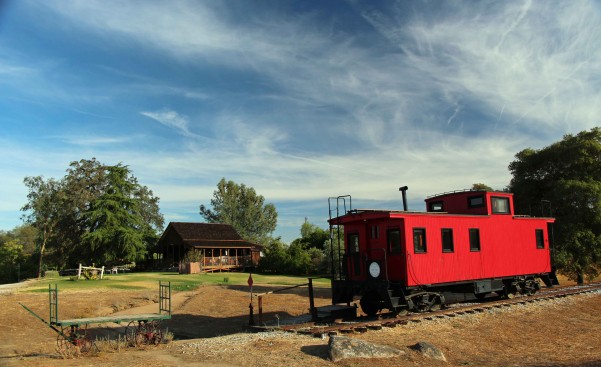
If you have kids, they will enjoy the fully-restored Southern Pacific caboose in front of the museum. The interior is exactly the way it would have been when it was operational. It was recently brought back to this condition by dedicated local volunteers.
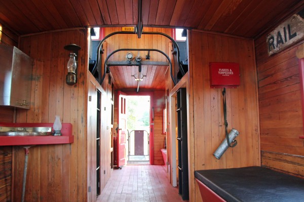
Inside the Caboose - PHOTO BY ADAM BLAUERT
In addition to the Charles Miller House and the caboose, there’s a fully-restored carriage house with a wagon, a buggy, harnesses, tack, ranch equipment, and historic photos.
Knowles Quarry Exhibit - PHOTO BY ADAM BLAUERT
How to find
To find Raymond, head south from Merced on Highway 99 and exit at Robertson Boulevard in Chowchilla. Drive east over the freeway and follow signs to Raymond: East on Road 26, South (right) on Road 29, East (left) on Road 603, Left (north) on Road 600.
When you arrive in Raymond, the museum will be on your right. Look for the red caboose and you won’t miss it.
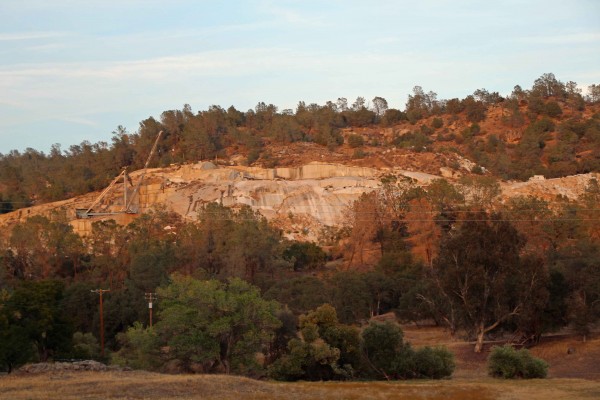
Knowles Quarry - PHOTO BY ADAM BLAUERT
The address is 31956 Road 600 (also known as Raymond Road) – slightly less than an hour’s drive from Merced. It is open Sundays from noon to 4PM and by appointment.
Schools welcome
School and homeschool groups are welcome and there are tables where you can enjoy a picnic or sandwiches from the town’s general store. The Frontier Inn also offers food.

A good museum or historic site only has the opportunity to become a great one when there’s someone who knows all about it and has a passion to explain it to everyone who comes to visit.
Raymond area cattle ranchers Lynn and Wayne Northrop have poured thousands of hours into making this museum a fun place to learn about history and I really enjoyed meeting Lynn on my recent visit. She knows just about everything there is to know about Raymond, its history, and its many connections with Yosemite and her enthusiasm about it is contagious.
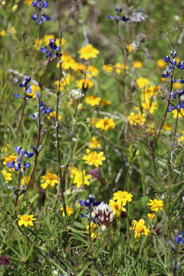
Although hot in summer, Raymond is an enjoyable place to visit in the fall, winter, or spring – especially during wildflower season (late March through May).
For more information about special events
go to: http://www.yosemitethisyear.com/events/index.php?eID=2236.

Raymond General Store - PHOTO BY ADAM BLAUERT
Raymond’s general store/bar has the unofficial status of a living museum. It hasn’t changed much since it opened in 1914. The left side of the building is occupied by the bar, while the right side is occupied by the store. The store offers sandwiches, and the Frontier Inn Tavern on Front Street (visible from the main road) also offers food.
Another place you can enjoy a good meal and historic photos at the same time is the Hills Pride Inn in nearby Knowles.
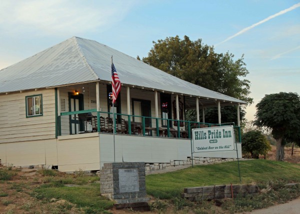
Hills Pride Inn - PHOTO BY ADAM BLAUERT
To visit Knowles, continue through Raymond on Road 600 and turn right on Road 415. Turn right again on Knolwes Road (Road 606).
After you pass the Hills Pride Inn on the right, look for the quarry on the left and the granite St. Anne’s Chapel on the right. This beautiful structure was originally built as the Knowles School in 1920, abandoned in 1942, and restored as a church in 1961-1962.

Yosemtie Transportation Artifacts - PHOTO BY ADAM BLAUERT
If you find Raymond’s transportation history interesting, you can find one of the stagecoaches that ran the Raymond to Yosemite route in the Madera County Museum.
For more information about the Raymond Museum, go to:
http://www.southyosemitemuseums.org/rm/
You can also contact the museum’s curator, Lynn Northrop, at wandernranch@sti.net
or by calling (559) 689-1886.

Merced County Wildlife Refuges

photo by adam blauert
Merced County Wildlife Refuges
Most of the acreage is managed by the U.S. Fish and Wildlife Service, with additional areas under the jurisdiction of the California Department of Fish and Game.
Recommended areas to visit
Merced Wildlife Refuge - PHOTO BY ADAM BLAUERT
Merced National Wildlife Refuge
Merced Unit: Auto tour, hiking trails, viewing platforms
San Luis Refuge - PHOTO BY ADAM BLAUERT
San Luis National Wildlife Refuge
San Luis Unit: Elk and waterfowl auto tours, hiking trails, viewing platforms, visitor center.

San Luis Refuge - PHOTO BY ADAM BLAUERT
San Luis National Wildlife Refuge Complex
The largest unit is the San Luis National Wildlife Refuge Complex, which is made up of several individual units including the Merced National Wildlife Refuge and the San Luis National Wildlife Refuge.
Much of this area is open to the public for a variety of recreational uses.
Tule Elk
In addition to the many avian species, a herd of magnificent tule elk can be viewed in the San Luis Unit on Wolfsen Road north of Los Banos. Once hunted nearly to extinction, stable populations now live in several areas throughout the state.

San Luis Refuge - PHOTO BY ADAM BLAUERT
Birds
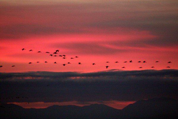
The refuge complex is located along the Pacific Flyway, an important migration corridor for dozens of species of waterfowl and other birds.
Some of the most common include Ross’ geese, Aleutian cackling geese, snow geese, green-winged teal, mallard, northern pintail, gadwall, American wigeon, northern shoveler, and white-fronted geese.
The refuge complex constitutes the largest contiguous freshwater wetlands remaining in California.
While wildlife can be viewed throughout the entire year, the wintering populations of lesser Sandhill cranes and Ross’ geese are a highlight. They arrive in the fall and stay until about mid-April, eventually returning to their summer homes in Alaska and Canada.

San Luis Refuge - PHOTO BY ADAM BLAUERT
Some remain throughout the summer and use the area as a breeding ground. During the foggy winter months, afternoon is usually the best time to visit.
In addition to wetlands, vernal pool and upland habitat also abound in the refuge. As the ground dries out in the spring, a brilliant wildflower show occurs in the vernal pool regions.
Visitor Center

Interpretive displays and group programs will be offered. Special tours and programs can be arranged for schools, clubs, and other organizations. For information about the new visitor center click here.
Useful websites for the San Luis Wildlife Refuge Complex
San Luis NWR main website: http://www.fws.gov/sanluis/default.htm
Each refuge area with public access is described below with its principal recreational features and facilities. Check each individual area for specific rules regarding hunting and fishing.
Catfish and bass are the most common fish species. Hunting regulations and types of game vary by area, but can include all waterfowl and upland game birds, deer, and wild pigs. Horses are not permitted.
For additional information, use the web links to access resources provided by the U.S. Fish and Wildlife Service and the California Department of Fish and Game.
Merced National Wildlife Refuge - Merced Unit
The main unit of the Merced NWR is open to both auto touring and hiking on three designated trails. Only a few miles from Merced, this is a great place to spend an afternoon in the fall, winter, or spring.
Location: Sandy Mush Road, west of Highway 59.
Activities and Facilities:
Wildlife viewing
Auto tour route – 5.2 mile auto tour route circles the heart of the refuge with four viewpoints, two observation decks and access to three hiking trails. Visitors are asked to remain in their vehicles except at these points.
Hiking trails
Meadowlark Trail – 1.5 mile loop
Kestrel Trail - .5 mile loop
Bittern Marsh Trail - .6 mile loop
Hunting
Restrooms
A photo blind is available for nature photographers by obtaining a special use permit. Vernal pools can be observed north of Sandy Mush Road. Pets are allowed as long as they remain in vehicles. No fishing is allowed in this refuge area.
Merced National Wildlife Refuge – Lone Tree Unit
This area is only open to hunting.
Location: Sandy Mush Road, west of Highway 59. Adjacent to Merced Unit.
Activities and Facilities
Hunting
San Luis National Wildlife Refuge – Blue Goose Unit
This area is only open to hunting.
Location: Highway 140, east of Gustine. Adjacent to Kesterton Unit.
Activities and Facilities:
Hunting
San Luis National Wildlife Refuge – Freitas Unit
This area is only open to hunting.
Location: Highway 140, east of Gustine. Adjacent to Kesterton Unit.
Activities and Facilities:
Hunting
San Luis National Wildlife Refuge - Kesterson Unit
In the late 1980’s, the selenium-contaminated Kesterton Reservoir was drained, decontaminated, and redeveloped as an addition to the San Luis NWR. It now provides over ten miles of unsigned hiking trails and great opportunities to view wildlife.
Trails are not marked, but visitors are welcome to wander around outside of hunting season.
Location: Highway 140, east of Gustine
Activities and Facilities:
Wildlife viewing
Hiking trails: Kesterton contains a network of over 10 miles of interconnected nature trails. These trails are open from February 15 – September 15.
Hunting
San Luis National Wildlife Refuge - San Luis Unit
This part of the SLNWR offers the widest range of activities. Two auto tour routes and three hiking trails give visitors a chance to observe tule elk and many bird species. The new visitor center is now open. The new visitor center provides an opportunity to learn more about the refuge and its inhabitants.
Location: Wolfsen Road, north of Los Banos.
Activities and Facilities:
Wildlife viewing
Auto tour route
Elk Tour Route – 5 miles
Wetlands and Waterfowl Tour Route – 12 miles
Visitor center
Dogs allowed
Hiking trails
Sousa Trail – 1.2 miles to an observation platform and telescope
Chester Trail – 1 mile (Open February 15 – September 15) This trail leads to the San Joaquin River and the site of Chester, an early settlement in Merced County.
Winton Marsh Trail - .7 mile to an observation platform and benches
Hunting
Fishing – a special access road on the west side of the elk enclosure provides access to all fishing areas.
Restrooms
Drinking fountains
San Luis National Wildlife Refuge - West Bear Creek Unit
This area offers hiking trails and an auto tour route. It receives less visitation than other parts of the San Luis NWR.

San Luis NWR - PHOTO BY ADAM BLAUERT
Location: Highway 165 (Lander Avenue), north of Los Banos
Activities and Facilities
Wildlife viewing
Auto tour route: 2 ¼ mile route around a large wetlands slightly west of the San Joaquin River with two viewpoints.
Hiking trails:
Woody Pond Trail – approximately 1.5 mile loop trail with viewpoint
Raccoon Marsh Trail – approximately 1 mile loop trail with viewpoint
Hunting
Restrooms
Wildlife Refuges Operated by the California Department of Fish and Game
In addition to the 128000 acres managed by the US Fish & Wildlife Service, another 24,000 acres are managed by the California Department of Fish and Game. These include:
Cottonwood Creek Wildlife Area
Los Banos Wildlife Area
North Grasslands Wildlife Area
O’Neill Forebay Wildlife Area
San Luis Reservoir Wildlife Area
Volta Wildlife Area
West Hilmar Wildlife Area
State Wildlife Refuges Map: http://www.dfg.ca.gov/lands/wa/region4/docs/LosBanosGrasslandsVoltaWA.pdf
"Each refuge area with public access is described below with its principal recreational features and facilities. Check each individual area for specific rules regarding hunting and fishing.
Catfish and bass are the most common fish species. Hunting regulations and types of game vary by area, but can include all waterfowl and upland game birds, deer, and wild pigs.
Horses are not permitted. Hiking biking are allowed from the end of the second week in February through September. Bicycles may be ridden on levee roads.
Dogs are permitted and may be off leash from June 6 through the end of March. Drawdown of the waters within the refuges usually takes place in spring and the refuges remain largely dry until the late fall.
For additional information, use the web links to access resources provided by the U.S. Fish and Wildlife Service and the California Department of Fish and Game.”
Cottonwood Creek Wildlife Area
Location: Western edge of Merced County, northeast of Highway 152
Activities:
Wildlife viewing
Hunting
Website: http://www.dfg.ca.gov/lands/wa/region4/cottonwoodcreek.html
Los Banos Wildlife Area
Location: Northeast of Los Banos on Henry Miller Avenue
Fishing and kayaking are allowed on Buttonwillow and Ruth Lakes. Catfish and crappie are the most commonly caught fish species.
Activities and Facilities:
Wildlife viewing
Hunting
Fishing
Boat launch
Restrooms
Drinking fountains
No designated trails, but foot and bike access is allowed throughout the area.
Website: http://www.dfg.ca.gov/lands/wa/region4/losbanos.html
North Grasslands Wildlife Area
China Island Unit: Brazo Road, northeast of Highway 33, between Gustine and Newman
Gadwall Unit: Santa Fe Grade Road, east of Los Banos
Salt Slough Unit: North of Los Banos on Highway 165 (Lander Avenue)
Activities and Facilities:
Wildlife viewing
Hunting
Fishing
Boat launch
Website: http://www.dfg.ca.gov/lands/wa/region4/northgrasslands.html
O’Neill Forebay Wildlife Area
Location: Highway 33, just north of Highway 152. Adjacent to San Luis State Recreation Area.
Activities and Facilities:
Wildlife viewing
Hunting
Restrooms
Website: http://www.dfg.ca.gov/lands/wa/region4/oneillforebay.html
San Luis Reservoir Wildlife Area
Activities and Facilities: South of Highway 152 at Dinosaur Point Road. Adjacent to San Luis State Recreation Area, Pacheco State Park and Upper Cottonwood Creek Wildlife Area.
Wildlife viewing
Hunting
Restrooms
Website: http://www.dfg.ca.gov/lands/wa/region4/sanluisreservoir.html
Volta Wildlife Area
Location: Ingomar Grade Road, northwest of Los Banos.
Activities and Facilities:
Wildlife viewing
Hunting
Website: http://www.dfg.ca.gov/lands/wa/region4/volta.html
West Hilmar Wildlife Area
Location: Four miles south of Hills Ferry on the east side of the San Joaquin River.. Accessible only by boat.
Activities and Facilities:
Wildlife viewing
Hunting
Website: http://www.dfg.ca.gov/lands/wa/region4/wes
Western Merced County boasts over 152,000 acres of wildlife refuges and conservation easements. Making up over 12% of the county’s total land area, these refuges are home to tule elk and a wide range of migratory birds.
Popular for wildlife viewing and hunting, the refuges also offer auto tour routes, hiking trails, and viewing platforms with telescopes.
Fishing is allowed in many areas. Access to all areas is free.
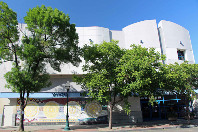
Merced’s Multicultural Arts Center

photo by adam blauert
Downtown Merced’s Multicultural Arts Center
is the local place to enjoy art, purchase art from local artists, and take art and dance classes.
Classes and galleries are operated by the Merced County Arts Council, which has supported art and art education in our area since 1978. Art by local artists is offered for sale in the ground floor area occupied by Arbor Gallery, a local artists’ cooperative.

Second floor gallery - PHOTO BY ADAM BLAUERT
The first and second floors house regularly-rotating exhibits. Special exhibits change several times a year – the last time I visited the main exhibit was an impressive collection of photos by the Merced Camera Club.

Ground floor gallery - PHOTO BY ADAM BLAUERT
Ground floor
Arbor Gallery sells local art in a broad variety of mediums: beautiful paintings, ceramics, photography, drawings, textiles, sculpture, glass, turned wood, jewelry, giclee prints and greeting cards.
Many feature local scenes or are made from local materials. On my recent visit I was surprised by the affordability of many of the pieces I liked the best.
The ground floor also houses a small theater where performances of music and dance are frequently offered.
Arts Merced also partners with the Merced Symphony, Playhouse Merced, the Merced Art Hop, and has sponsored music at downtown locations like Coffee Bandits, the Art Kamangar Center at the Merced Theatre, Merced College, Applegate Park, and the Merced Community Center.
Performances for kids in grades 3-8 are offered on the second Saturday of each month from January through May and September through November.

Stairs to upper levels - PHOTO BY ADAM BLAUERT
The third floor
Offers classes for both children and adults. Frequently offered physical activity courses include world dance and capoeira (a Brazilian martial art that combines dance, acrobatics, and music).
Dance groups Sol del Valle (ballet folk lorico), and Merced Academy of Dance (ballet) also use the building and offer opportunities for local youth to learn traditional dances.
Art classes
Include ceramics, acrylic painting, comic books, drawing basics, painting, digital photography, yarn arts, and. New classes begin monthly.
The center also offers an arts-based adult day program for developmentally disabled adults.
The ARTREE program that puts working artists in local K-12 classrooms is also part of the Merced County Arts Council, along with the Arts in the Valley radio program that airs every Saturday at 8PM on KYOS 1480.
The Arts Center is open 11AM-7PM Wednesday-Thursday and 10AM-5PM Friday-Saturday. Arbor Galley is open 11AM-6PM Tuesday-Friday and 10AM-2PM on Saturdays.
Admission to both the Arts Center and Arbor Gallery is free.
For more information, and for a schedule of events, classes, performances, tours, and special events-see website - click here- MCAC.
or call (209) 388-1090.
For more information about Arbor Gallery, go to Arbor Gallery
or call (209) 384-8338.

Great Bike Paths in Merced County


Bike Paths - photo by adam blauert
Bike Path in Merced
Merced County communities have an extended network of bike paths and bike lanes with many more planned for future construction. This network is made up of three distinct classes of pathways, lanes, and routes.

Bear Creek Bikeway - PHOTO BY ADAM BLAUERT
Class 1: Separate pathway for bikes, pedestrians, skateboards, and other non-motorized uses.
Class 2: A separate bike lane along the edge of a road; indicated by a striped line.
Class 3: A designated route without painted lines to indicate a separate bike lane.

Bike Paths - PHOTO BY ADAM BLAUERT
There are many miles of bike paths in Merced
Merced bike paths on Google Maps (click here)
Great links for local information about bicycling in Merced County.

Bear Creek Bikeway - PHOTO BY ADAM BLAUERT
Additional Information
For additional information on biking, bike maintenance, bike events, and riding in Merced County, check out the website:
Merced Bicycle Coaliton : http://www.mercedbicyclecoalition.org/
Trans_Logo_Large_600

boy on merced city bike trails
Bike Licensing
Bikes owned by residents of the incorporated areas of Merced County (Atwater, Dos Palos, Gustine, Livingston, Los Banos, Merced) must be licensed.
A 3-year license costs $5 and is available from the police station in your city. The information typically required in the license form includes band, model, serial number, wheel size, and frame size.
The City of Merced provides its license information here. CLICK HERE
To obtain a license, visit your local police station
City of Atwater Police Department - 750 Bellevue, Atwater / (209) 357-6385
City of Dos Palos Police Department - 1546 Golden Gate Ave, Dos Palos / (209) 392-2177
City of Gustine Police Department - 682 3rd Ave, Gustine / (209) 854-3737
City of Livingston Police Department - 1446 C Street, Livingston / (209) 394-7916
City of Los Banos Police Department - 945 5th Street, Los Banos / (209) 827-7070
City of Merced Police Department - 611 West 22nd Street, Merced / (209) 385-6912
Bikes on the Bus: Bike racks are provided on Merced County Transit Busses (The Bus).

Meux Home Museum

photo by adam blauert
The Meux Home
Most nearby counties – Mariposa, Stanislaus, Tuolumne, San Benito, Madera – and our own, have museums of county history. Surprisingly, Fresno County doesn’t.
The Fresno Historical Society has a long-term goal of developing one at Kearney Park, but it may not happen for many years to come.
That said, Fresno does have two meticulously preserved and restored mansions – the Meux Home and the Kearney Mansion. The city of Fresno was laid out by the Central Pacific Railroad in 1872, but not incorporated until 1885.
The Meux Home was built in 1888-89, just after the incorporation. At that point the town had about 10,000 residents.
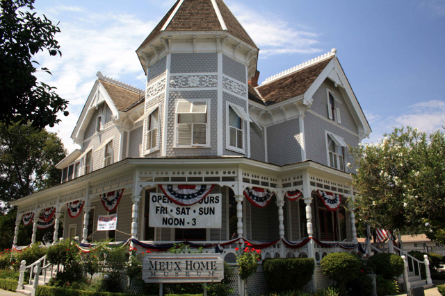
Meux Home Museum - PHOTO BY ADAM BLAUERT
Dr. Meux
The Meux Home is one of the oldest surviving structures in the town. Built for Dr. Meux and his wife Molly, it was occupied by the Meux family from 1889 to 1970. Dr. Meux was a surgeon in the Confederate Army from 1861 to 1865. The Meux family moved to California in 1887 because of Molly’s poor health.
Although Molly continued to suffer poor health and eventually became both deaf and blind, the climate of Fresno was an improvement for her and she survived until 1922. Her daughter Anne lived in the house until her death in 1970. Anne’s occupation of the home insured its preservation with few changes. After her death, the house sat vacant for a couple of years but was eventually restored to its original splendor.
When you visit
Visitors can enjoy that splendor on docent-led tours offered on Fridays, Saturdays, and Sundays from noon to 3:30PM. Tours are conducted by well-informed docents in period costume. Visitors learn about the Meux family, the Victorian era, and the early history of Fresno. Admission is $5 for adults, $4 for teens 13-17, $3 for children 5-12, and free for children under 5. The home is also available for rent for weddings and other special occasions.
Special Events
The Meux Home Museum offers a number of special events and displays throughout the year.
February: Flapper’s Valentine Party
Spring: Lampshade Guild Display
Mother’s Day Tea
September-October: Fall Festivities (more information to follow on the Meux Home’s website)
Information about Tours
Tours include ten ornate rooms on both the first and second floors. Special exhibits and displays change seasonally. The first floor is accessible to all visitors regardless of mobility via a wheelchair lift. The Meux Home is located at 1007 R Street in Fresno (corner of R and Tulare), between the 99 and 41 freeways.
For more information, go to http://www.meux.mus.ca.us/index.html or call (559) 233-2331. Free parking is located next to the Meux Home.
I really enjoyed my tour of the Meux Home. I’d always had trouble picturing Fresno’s Victorian period, but the house brought it to life for me. One of the biggest surprises was that the home was considered a middle class residence in the time it was built.
Today its ornateness and size make it seem like a home built for a family further up the economic scale.
Learning about the past
Visiting historic sites like the Meux Home is a great way to learn about the past. Sometimes these places challenge our expectations and assumptions about other ages.
While in the area, there are a number of other historic landmarks to see. Although many of Fresno’s oldest homes have been lost to time and progress, there are a number of interesting structures in the vicinity.
For historic driving and walking tours, go to http://historicfresno.org/tours/nrhp.htm.
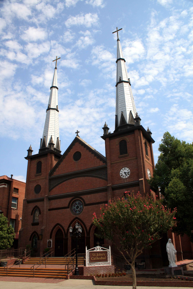
St. John's Exterior - PHOTO BY ADAM BLAUERT
St. John’s Cathedral
A block northwest of the home at R and Mariposa Streets is Fresno’s St. John’s Cathedral. Dedicated in 1903, the brick cathedral was carefully restored between 1997 and 2002.
The structure was seismically retrofitted, a new slate roof was installed, and the artwork and stained glass windows were meticulously restored by an art conservator and restorer who had previously worked on six of the California missions and San Jose’s cathedral.

St. John's Interior - PHOTO BY ADAM BLAUERT
If there isn’t a service in progress, you can take a quiet and respectful look inside the cathedral after you tour the Meux Home Museum.
For more information go to http://stjohnsfresno.org/.
Fresno’s iconic American Romanesque water tower, built in 1894, is also nearby. Located at 2444 Fresno Street, it serves today as a galley for local artists.
It is open 10AM-4PM Monday-Saturday, except federal holidays.

Fresno Water Tower - PHOTO BY ADAM BLAUERT
For more information
It offers information about Fresno-area activities and recreation. There’s also an Art Hop reception on the first Thursday of each month from 5 to 8PM.
For more information go to http://www.artbyhandgallery.com/
or call (559) 477-6231.
Other historic homes within an hour’s drive of Merced that offer tours include:
Sources:
http://www.meux.mus.ca.us/index.html
http://historicfresno.org/tours/nrhp.htm
http://historicfresno.org/nrhp/wtrtwr.htm
http://www.artbyhandgallery.com/
http://www.fresno.gov/Government/DepartmentDirectory/DARM/HistoricPreservation/History.htm
Dos Palos Museum

photo by adam blauert
History in the valley
Although the Merced County Historical Society Museum displays history of the entire county in Merced’s old courthouse building, it is augmented by history museums in other communities throughout the county.
Each town has its own story to tell and Atwater, Dos Palos, Gustine, Livingston, and Los Banos all have organized museums to tell these stories.
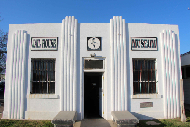
Dos Palos’ Jail House Museum is located in the town’s old jail building at 2020 Almont Street. South of Highway 152, East of I-5, and west of Highway 99, Dos Palos is “off the beaten track” for most residents of Merced County.
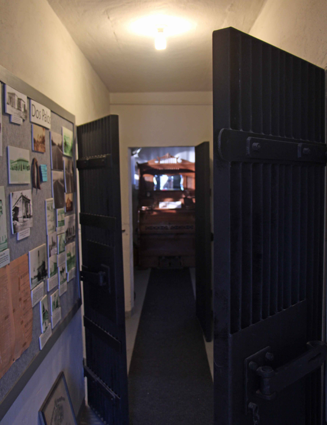
Museum Interior - PHOTO BY ADAM BLAUERT
Founded in the 1890’s as a colony development named Colony Center, the name was officially changed to Dos Palos in 1906 – a place name that dates back to the first land grants issued in the area when California was still a part of Mexico.
Dos Palos built one of the first high schools in Merced County (1907) and incorporated in 1935.
Today it has a population of about 5,000 people.
Dos Palos’ museum is one of the newest in the county
Like other small museums, it offers unique artifacts and glimpses into history that you won’t see in larger museums that tend to generalize history into broad trends and focus on the best-known and most influential historical characters.
The museum has an especially interesting collection of photos Some of the most interesting images I saw during my recent visit include:
Basketball games inside the old gymnasium (no longer standing) at the original Dos Palos High School
Steamboats on the San Joaquin River in the early 1900’s
Downtown Dos Palos after the 1911 fire
Barrels of wine confiscated in a Prohibition-era raid being dumped into the Dos Palos sewer
Comparison shots of downtown Dos Palos before and after the installation of streetlights. Nighttime was dark in a small town without them!
Ice skating on a frozen canal in 1913

Veterans Memorial - PHOTO BY ADAM BLAUERT
Directions and cost
The museum is open from 9AM to 12 noon on the second and fourth Saturdays of each month. To find the museum, exit south Highway 33 from Highway 152.
Follow 33 to Almond Avenue and turn left. Look for the old jail on the left after you pass California Street. For more information about the museum you can call (209) 392-3064.
Admission is free.
Dos Palos also has a veterans memorial located in front of Bernhard Marks Elementary School at 1717 Valeria Street.
© Copyright 2013 Adam Blauert
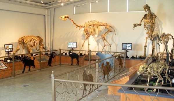
Fossil Discovery Center of Madera County

PHOTO BY ADAM BLAUERT
Fossil Discovery Center of Madera County
From Antiques Roadshow to American Pickers and Pawn Stars, popular TV shows have long featured treasures found in unlikely places. Just a few miles south of the Merced County line, a new museum displays treasures found in a dump.
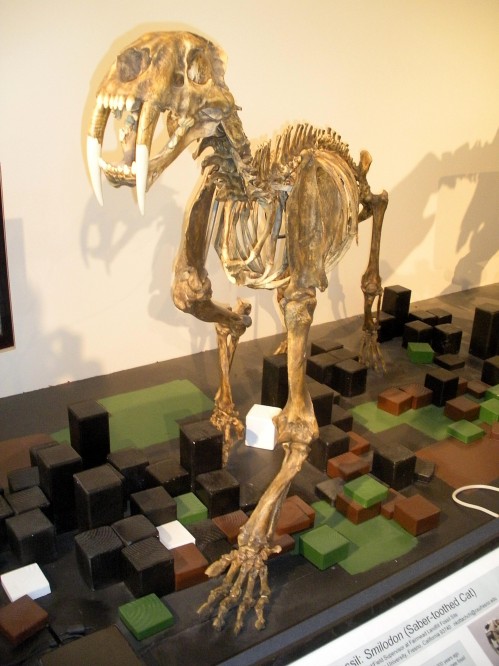
Photo By Adam Blauert
Location
Situated along Highway 99 between Chowchilla and Madera, the small community of Fairmead is now home to the Fossil Discovery Center of Madera County. The excitement started in 1993 when sanitation workers at the Fairmead Landfill discovered part of a mammoth tusk.
Experts were called in and the discoveries have continued. Scientists have dated the Farimead fossils to the Middle Pleistocene age – roughly 500,000 to 780,000 years ago. Surprisingly, the fossils were only twelve feet below the surface!
Many of the most interesting results of the excavations have been on display since the museum opened last fall. On weekdays visitors can watch fossils being removed from the dirt and examined in the on-site lab.

Photo By Adam Blauert
Although especially good for children
Visitors can learn a lot about the natural history of our region. The Central Valley was underwater during the age of the dinosaurs, so the Fairmead fossils provide a glimpse into a later period when Pleistocene horses, Columbian mammoths, sabre-toothed cats, short-faced bears, dire wolves, camels, and several species of sloths roamed the area that we now call home.
Thousands of specimens representing 39 species have been discovered
Fresno State paleontologists oversee the continuing excavations.
Start your visit with the short well-produced video introduction to the museum. It provides a good overview of the site’s significance. You can tour the exhibits on your own but we definitely felt that we learned far more by taking a guided tour. Many displays feature items that can be touched and examined up close.
The weight of some of the fossils may be a surprise to some. Many are not completely fossilized and weigh more than might be expected. On some days children can participate in mock fossil digs in an outdoor area adjoining the museum. Call ahead to find out when these mock digs are offered.
The Fossil Discover Center is a great outing during the inclement weather of the colder months.
To get there, take Highway 99 south to exit 164 (Avenue 21 ½.) Turn left (west) and you will see the Center at the intersection of Avenue 21 ½ and Road 19 ½.
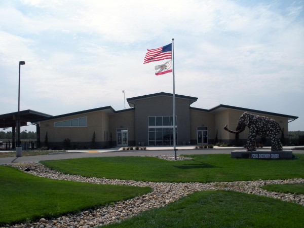
Photo By Adam Blauert
Video
Admission Prices and Hours
For more information go to: https://www.facebook.com/p/Fossil-Discovery-Center-of-Madera-County-100044939594993/
or call( 559) 665-7107.

Screen Shot 2014-05-27 at 8.15.11 PM
Tours for groups or schools can be arranged.

Sierra Foothill Conservancy

PHOTO BY ADAM BLAUERT
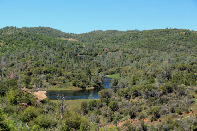
Most of the best hiking trails between Merced and Yosemite National Park are located on land surrounding the large reservoirs that provide water for farms, businesses, and homes. Much of the remaining land is privately owned, providing homes for families and food for the world. In the last couple of decades, some of that land has been put into conservation easements. These easements ensure that it will continue to be a part of the economy as grazing land and also ensure that it will not become urbanized.

Van der Ahe - PHOTO BY ADAM BLAUERT
Easements are voluntary and permanent legal decisions made by the landowners. Essentially they sell their development rights while continuing to run productive livestock operations. Easements help to preserve open space and a ranching-based economy without government ownership of the land or removal of the land from the economy.
Stockton Creek - PHOTO BY ADAM BLAUERT
Many families who have chosen to put an easement on their land have lived on the land and loved it for generations. The easement is as a way to preserve it land for future generations, no matter whether their family continues to own it or not.

Stockton Creek - PHOTO BY ADAM BLAUERT
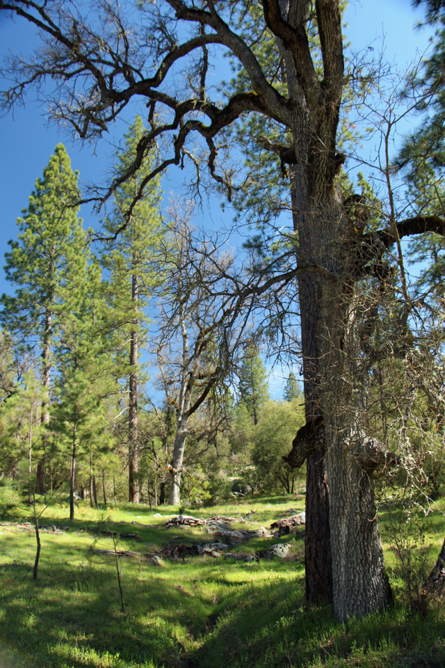
In the foothills of Mariposa, Madera, and Fresno Counties, a majority of these easements are overseen by the Sierra Foothill Conservancy. The Conservancy has developed strong working relationships with these landowners and the result is that many are willing to allow the Conservancy to hold classes and guided hikes on their properties. The Conservancy also owns and/or manages nine preserves where cattle generally remain part of the land’s management plan, but which are open to the public on a more frequent basis.
The Madera and Fresno County preserves
Three of these preserves – Stockton Creek, Feliciana Mountain, and Bean Creek – are located close to home in Mariposa County.
The Madera and Fresno County preserves are also within a driving distance of one and a half to two hours. Mariposa area classes and hikes may occur on the preserves or on easements in a wide range of elevation zones.
These easements include Striped Rock, Clark’s Valley, and ranch land near Hornitos, Bear Valley, and Darrah.

Van der Ahe - PHOTO BY ADAM BLAUERT
Hikes and classes
Hikes and classes aren’t offered during the intense heat of summer, but they will begin again in October and run through May. The majority of events occur as the weather improves between February and May.
This fall’s Mariposa County events – including a hike through oak woodlands to expansive views from the top of Striped Rock and an autumn-themed nature photography workshop at Stockton Creek – will be posted on the Conservancy’s website (www.sierrafoothill.org) by the middle of September.

Van der Ahe - PHOTO BY ADAM BLAUERT
Hikes
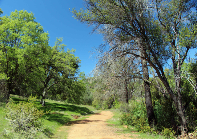
The relatively easy Stockton Creek Trail in the Stockton Creek Preserve near downtown Mariposa is open daily from sunrise to sunset.
The trail’s route includes Stockton Creek Reservoir (the source of Mariposa’s drinking water) and a ridge that overlooks the town of Mariposa with views of the surrounding mountains.
Most hikers start at water treatment facility at the end of Trabucco Road and climb over the ridge to the reservoir. You can also start on the south side of Highway 140, just east of the junction with Old Highway North.
Van der Ahe - PHOTO BY ADAM BLAUERT
Look for a turnout with a locked gate. There is a “walkaround” to the side of the gate. Eventually an additional section of trail will be built to connect the preserve with Slaughterhouse Road.
You can find easy-to-use hiking map at: http://www.sierrafoothill.org/index.php/land/preserves/stockton-creek/.
Stockton Creek - PHOTO BY ADAM BLAUERT
Power hikes
The Conservancy offers a broad range of hikes and classes. Designated “family hikes” are very easy and generally a good option for people of all ages. Many hikes and classes easy to moderate in difficulty.
More challenging “power hikes” may last all day and require some serious elevation gain – especially Tivy Mountain and the Table Mountain hikes that include Smith Basin.
All hikes are led by experienced guides who can explain the landscape, its plants and animals, and its history.
Classes offered on SFC preserves and easements include subjects such as birds, photography, native plants, astronomy, wildflowers, and trees.
The Sierra Foothill Conservancy does a great job of balancing habitat preservation with ranching, with a bonus of welcoming the public for informative and rewarding activities.
I’ve hiked several Sierra Foothill Conservancy trails and there are quite a few more that I hope to visit in the next couple of years. Perhaps I’ll see you on the trail!
Stockton Creek 2 - PHOTO BY ADAM BLAUERT
For more information, visit the Conservancy’s informative website: www.sierrafoothill.org.
The site details each of the preserves with stunning photos and offers a calendar of events.
You can contact the Mariposa office at (209) 742-5556 and the Prather office at (559) 855-3473.

George J. Hatfield Recreation Area Merced County

photo by adam blauert
George J. Hatfield Recreation Area
This state park has a mile of river frontage and plenty of shade. It’s proximity to the road and the poor condition of some of its facilities make it less favorable than some of the other parks on the river, but it still provides many excellent fishing opportunities.
Near the park is a historic bridge over the Merced River. Built in 1910, it is now open only to pedestrians and bikers. It provides nice views of the river.

Hatfield - PHOTO BY ADAM BLAUERT
Location
4394 North Kelly Road, Hilmar, CA
Distance from Merced: 30 miles
Distance from Los Banos: 29 miles
Size: 46.5 acres
Facilities and activities
Flush restrooms
Drinking fountains
Campgrounds/group campgrounds with BBQ grills/fire rings
Picnic areas with tables, shelters, and BBQ grills
Group picnic areas
Swimming area
Dogs allowed? Yes
Horses allowed? No
Hunting allowed? No
Fishing or boating?
Fishing can be good at George J. Hatfield Recreation Area. Rainbow trout and bass can be caught in the spring; catfish and perch throughout the year.
No boating ramp is provided, but it is possible to swim in the river or to launch a float tube or hand-carried boat.
Website
Hatfield Recreation (click Here)
Nearby Parks
Undeveloped Great Valley Grasslands State Park has a six mile hiking trail.
Kearney Park and Mansion

PHOTO BY ADAM BLAUERT
M. Theodore Kearney
During the mid-1800’s, the majority of people who visited the San Joaquin Valley couldn’t see the agricultural potential that would be unleashed through irrigation.
M. Theodore Kearney was one of the few who did and although his name may not be a household one, he played a major role in making the valley what it is today. The most visible legacies of his life are Fresno’s Kearney Mansion and Kearney Park.
Kearney started in 1875 by promoting and managing colony development systems in Fresno County. Land was subdivided and sold with irrigation and fencing provided, making grape and fruit growing both possible and affordable for middle class families.

Civil War - PHOTO BY ADAM BLAUERT
1883
In 1883 he began his biggest project – the Fruit Vale Estate. Kearney purchased 6,800 acres west of Fresno with the intention of making it the greatest agricultural colony yet established in the area.
Simply raising the investment capital to undertake the massive project – especially the irrigation system – required a three year trip to New York and Europe.
Work began as soon as he returned. Kearney selected 240 acres on the southern edge of his property for a park and grand estate that would serve as his headquarters.
He commissioned well-known landscape artist Rudolph Ulrich to design “Chateau Fresno Park” in what was then a barren plain. Within a few years the barrenness had been transformed into what was probably the best collection of trees, vines, shrubs, and roses in the United States.
Chateau Chenonceaux
In the center of it all, Kearney planned to build a five-story mansion based on the Chateau Chenonceaux in Tours, France. This ambitious plan was the culmination of the remarkable social and economic climb of a man who kept his working-class Irish immigrant background a closely-guarded secret in a time when it was not “respectable” to be Irish.
The chateau would be a place where Kearney could proudly entertain his European investors and friends.
Civil War - PHOTO BY ADAM BLAUERT
Kearney’s death in 1906 kept the chateau from being constructed. Kearney had been living in a large home on the property that was ultimately intended to be the Superintendent’s Lodge, a home for the ranch manager.
UC
Kearney willed his property to the University of California and the Lodge, now known as the Kearney Mansion, was used by the University until 1962. At that point the Fresno Historical Society began to transform it into a museum.
The home has now been a museum for over 50 years. Several restoration projects during that time period have returned it to its original appearance.
Over 70% of the furnishings and décor are original
The others have been matched from old photographs. Constructed in a French Renaissance style out of local materials, the mansion’s two-foot thick outer walls are actually plaster-covered adobe bricks.

Civil War - PHOTO BY ADAM BLAUERT
Hour-long tours of the Kearney Mansion are offered Friday, Saturday, and Sunday at 1, 2, and 3PM. Tour guides are knowledgeable and you will learn a lot about the history and development of our valley during your visit. While in the “mansion” you can see images of what Kearney’s planned chateau would have looked like.
If you’re interested in learning more you can pick up a copy of M. Theo Kearney: Prince of Fresno in the gift shop. Eventually the Fresno Historical Society plans to create a larger museum at the site to tell the story of the San Joaquin Valley and its people.
Admission to the mansion is $5 for adults, $4 for seniors, students with ID, and youths 13-17, and $3 for children 3-12. Children under 3 are free. Special Christmas tours are offered in December.
For more information
or call (559) 441-0862.

Kearney Park Picnic - PHOTO BY ADAM BLAUERT
An additional $5 is charged by the County of Fresno to enter the park. The park is open during daylight hours. In addition to the mansion, the park offers:
Shaded picnic tables and reservable group picnic shelters
Playgrounds
Soccer fields
Softball diamonds
Horseshoe pits
Annual Kearney Park events include
September: Highland Gathering and Gameshttp://www.scottishsociety.org/index.php?option=com_content&view=article&id=52&Itemid=55
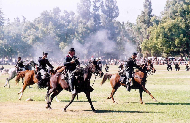
October: Civil War Reenactment http://www.valleyhistory.org/index.php?c=19
November: Kearney Park Renaissance Faire http://www.kearneyrenaissancefaire.com/
For more information about Kearney Park, go to http://www2.co.fresno.ca.us/4510/4360/Parks/parksresvinfo.htm
Kearny Park Tree-Lined Boulevard - PHOTO BY ADAM BLAUERT
Location
To get to Kearney Park from Merced County, head south on Highway 99, exiting at Grantland. Follow Grantland south for 7 miles until it ends at Kearney Boulevard.
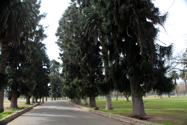
Turn left and watch for the park entrance on the right. The palm and eucalyptus trees around the park were planted by Kearney. They line Kearney Boulevard all the way into downtown Fresno where Kearney ends at Fresno Street.
Other historic home museums within an hour’s drive of Merced County include
Sources:
Rehart, Schyler and William K. Patterson. M. Theo Kearney: Prince of Fresno. Fresno: Dumont, 1988.
http://www.valleyhistory.org/index.php?c=58
http://historicfresno.org/nrhp/kearney.htm
http://www.scottishsociety.org/index.php?option=com_content&view=article&id=52&Itemid=55

Hensley lake ~ Very close to Merced County with many facilities

PHOTO BY ADAM BLAUERT
Hensley Lake
Less visited than nearby Eastman Lake, Hensley Lake has almost as many facilities and comparable fishing. Hensley Lake was created by a dam on the Fresno River.

Hensley Lake - PHOTO BY ADAM BLAUERT
Location: Roads 603 and 400 in Madera County
Distance from Merced: 42 miles
Distance from Los Banos: 69 miles
Operating Authority: U.S. Army Corps of Engineers
Surface Area of Lake: 1,570 acres

Hensley - PHOTO BY ADAM BLAUERT
Facilities and Activities:
Boat ramp
Chemical/flush restrooms
Drinking fountains
Campgrounds/group campgrounds with BBQ grills/fire rings, shelters, hot showers, electric hookups
Picnic areas with tables, shelters, and BBQ grills
Group picnic areas and shelters
Swimming area
Playground
Dump station
Hiking/biking/equestrian trails
Wildlife viewing area
Horseshoe pits
Dogs allowed? Yes
Horses allowed? Yes, and a large network of equestrian trails are available
Hunting allowed? Yes
Fish species: Bass, bluegill, catfish, crappie, sunfish. Rainbow trout during winter months.
Boat rentals: No

Hensley - PHOTO BY ADAM BLAUERT

Eastman Lake: Formed by a dam on the Chowchilla reservoir, this tends to be more popular than nearby Hensley Lake.

Eastman Lake
Eastman Lake: Formed by a dam on the Chowchilla reservoir, this tends to be more popular than nearby Hensley Lake.
Location: Road 29, Madera County
Distance from Merced: 43 miles
Distance from Los Banos: 70 miles
Operating authority: U.S. Army Corps of Engineers
Surface area of lake: 1,780 acres
Facilities and activities
Boat ramps
Flush restrooms
Drinking fountains
Visitor center
Campgrounds/group campgrounds with BBQ grills/fire rings, shelters, hot showers, RV hookups
Picnic areas with tables, shelters, and BBQ grills
Group picnic areas and shelters
Swimming beach
Playground
Dump station
Hiking/biking/equestrian trails
Wildlife viewing area
Softball diamond
Volleyball courts
Horseshoe pits
Hunting permitted
Dogs allowed? Yes
Horses and hunting
Yes - a large network of equestrian trails and an equestrian campground are available.
Hunting allowed? Yes
Fish species
Bass, bluegill, catfish, crappie. Rainbow trout during winter months.
Boat rentals: No

Reservoirs, Fishing, and Boating within an Hour of Merced County Communities

PHOTO BY ADAM BLAUERT
Hub for boating, fishing, and water recreation
Encircled by the reservoirs of the Central Valley’s irrigation system, Merced County is a hub for boating, fishing, and water recreation. From the foothills of the Sierra Nevada on the eastern side of the county to the Diablo Range on the west side, there are eleven lakes within an hour’s drive of all communities in the county.
Few counties have so many highly-rated areas for boating and fishing.
Running east to west across the county, the Merced River has many access points for fishing. Portions of the San Joaquin, Chowchilla, and Fresno Rivers also flow through the county. The Tuolumne and Stanislaus Rivers lie just outside the county’s borders. While a boat is necessary to access some of the best fishing areas, there are also many lesser-known locations to fish from the shore of a river or lake.
Hot months of summer
Most reservoirs and river access points offer camping, picnicking, swimming, and other recreational activities. Spring and fall usually have the most comfortable weather. Swimming, waterskiing, wakeboarding, and other kinds of water recreation are enjoyed during the hot months of summer.
For more information
Click on any of the reservoirs or river access points listed below for more details on that area. Links to websites maintained by each recreation area are provided for additional information, regulations, campground reservations, and contact information.

eastman lake PHOTO BY ADAM BLAUERT
Reservoirs:
San Luis Reservoir - O’Neill Forebay - Los Banos Creek Reservoir
Adam blauert
All kinds of boat and water recreation are allowed at these reservoirs except at Los Banos Creek Reservoir where a 5 mph speed limit keeps the lake calm for fishing. Please know and adhere to the speed limits posted at other lakes.
River Access in Merced County
The best river fishing in Merced County is along the Merced River. The river was named Rio de Nuestra Senora de Merced by a Spanish expedition in 1806. The current name and the name of the county were derived from this original name.
Running 112 miles from Merced Lake in the high country of Yosemite National Park, the river empties into the San Joaquin River at Hill’s Ferry in the northwestern corner of Merced County. From Merced Lake, the river cascades down Nevada and Vernal Falls, and then through the entire length of Yosemite Valley.
Controlling the snow melt
It is joined by smaller North and South Forks in the steep river canyon between Yosemite Valley and Lake McClure. The river is dammed by New Exchequer Dam at Lake McClure, McSwain Dam at Lake McSwain, a dam at Merced Falls, the Crocker-Huffman Dam between Merced Falls and Snelling, and several smaller dams.The river’s flow depends on the previous year’s snowfall.
Between Snelling and Hill’s Ferry the river is often slow and meandering, but it’s glassy surface can hide a strong current underneath. Exercise extreme caution if venturing into the river. In the upper regions Class IV and III rapids are common and the current can be overwhelming, even in the lower areas.
Safety First
Submerged hazards and deep holes in the channel of the river are not uncommon. Every year unprepared swimmers drown in the river.
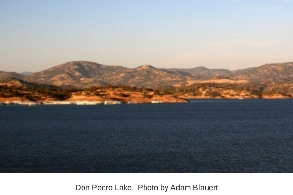
don pedro lake
Overall recommendations for best fishing with a boat
O’Neill Forebay and Don Pedro Lake are usually the highest-rated and most consistent fisheries in the area.
Lake McClure, Lake McSwain and Modesto Reservoir also generally provide excellent fishing.
Eastman Lake and Hensley Lake can be good when their water levels are high.
Best boating and water recreation

lake mcclure
O’Neill Forebay
Don Pedro Lake
Lake McClure.
Best river fishing
Bagby Recreation Area at Lake McClure at the MID and PG&E Fishing Access
George J. Hatfield State Recreation Area.
Reservoirs Closest to home
Los Banos: San Luis State Recreation Area
Merced: Lake Yosemite
Other fishing and boating resources
Fishing and Boating Resources at http://www.takemefishing.org/
Department of Fish and Game Regulations: http://www.dfg.ca.gov/
Department of Boating and Waterways Regulations: http://www.dbw.ca.gov/
Reservations for State, Federal, and Army Corps of Engineers Campgrounds:http://www.reserveamerica.com

Don Pedro Lake - One of California's highest-rated fishing area & 5th largest artificial lake

PHOTO BY ADAM BLAUERT
Don Pedro Lake
The fifth-largest artificial lake in California, Don Pedro is one of California’s highest-rated fishing areas. This Tuolumne River reservoir is also a prime area for all types of boat-based recreation.
The spectacular 4th of July fireworks show draws huge crowds.
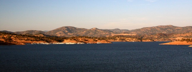
Don Pedro - PHOTO BY ADAM BLAUERT
Location: Bonds Flat Road, Highways 132 and 120
Distance from Merced: 35 miles
Distance from Los Banos: 71 miles
Operating authority: Modesto Irrigation District and Turlock Irrigation District
Surface area of lake: 13,000 acres
Facilities and activities:
Rentals: Boats and personal watercraft including houseboats
For more information
Website: http://donpedrolake.com/index.htm
Special Events
Annual 4th of July fireworks show.

Pacheco State Park
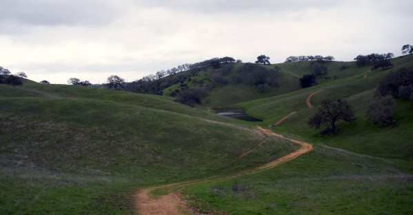
PHOTO BY ADAM BLAUERT
Mexican land grant
This park preserves part of a large Mexican land grant given to the Pacheco family in 1843. 28 miles of trails are available for hiking, biking, and equestrian use. Thousands of acres of gently rolling oak woodland produces spectacular wildflower displays in the spring. The ruins of the Pacheco Adobe and a well-preserved line shack from Henry Miller’s ranching operation stand near the picnic area.

Photo by akshay
Location
Accessed from Highway 152. Distance from Merced: 59 miles Distance from Los Banos: 23 miles Size: 6,890 acres
Facilities and Activities
Chemical/flush restrooms
An equestrian campground is available for special events; other campgrounds are available at the adjacent San Luis State Recreation Area
Picnic areas with tables
28 miles of hiking/biking/equestrian trails
Wildlife viewing
Wildflower viewing
Dogs Allowed? In picnic area, but not on trails
Horses Allowed? Yes
Hunting Allowed? No
Fishing or Boating? No
Website information
http://www.parks.ca.gov/pages/560/files/PachecoSP_2011.pdf
http://www.parks.ca.gov/?page_id=560
See for a trail guide
http://www.parks.ca.gov/pages/560/files/PachecoTrailMap2006small.pdf

Photo by akshay
Special Events
Ranger-led wildflower hikes in the spring. A kite flying day is also held annually.
Nearby Parks
Camping is available at the adjacent San Luis State Recreation Area
Adam Blauert, a high school teacher and avid outdoors enthusiast, has dedicated the majority of his life to Merced County. His passions include fishing, backpacking, delving into local history, and exploring the wonders of the western states.