
MJC’s Great Valley Museum and Planetarium
Photo by Adam Blauert
What’s the best new thing within an hour’s drive of home? It’s the recently reopened Great Valley Museum and the brand new William R. Luebke Planetarium at Modesto Junior College. An impressive state-of-the-art museum about local species and habitats, it is housed in the beautiful new Science Community Center at MJC. Planetarium shows are regularly scheduled on Fridays and Saturdays.
The original Great Valley Museum closed a couple of years ago in preparation for the move to the Community Science Center. It reopened in April 2015, reborn with extensive world-class displays of local wildlife and their habitats.
Although the majority of visitors are Modesto-area elementary students, the museum’s exhibits are designed to be interesting to all ages. My wife and I learned a lot during our recent visit.
Photo by Adam Blauert
The museum’s displays meticulously recreate local habitats with every major species represented. You see the animals up close. They can’t fly or run away, so it’s much easier to observe their features than in the wild. Informative signs provide the names and interesting facts about them. Although a few displays are still being completed, the majority are finished.
The attention to detail is spectacular. The more you look, the more you notice less-visible species hiding amidst the plant life – just the way it is in nature. This is a great place to learn about the species before you go out to observe them at one of our local wildlife refuges.
Photo by Adam Blauert
The largest displays depict local wetlands. The wetlands displays are surrounded by smaller displays of birds and mammals of all sizes including elk, pronghorn, mountain lion, raptors, fish, and extinct species such as grizzly bear, gray wolf, and jaguar.
There’s a nice collection of Native American artifacts and a display about giant fossil salmon and tortoises excavated at Turlock Lake by CSU Stanislaus. The museum also offers “Science on a Sphere.” A system of four projectors displays moving images on a large globe suspended from the ceiling.
During our visit it was being used to display satellite imagery of historical global weather patterns, including El Nino events from the past few decades. The museum has an extensive list of educational programs they can project on the sphere. It’s an outstanding teaching tool for understanding our how our planet functions.
Want to learn more about the elements of the periodic table? The museum has an interactive periodic table with short video clips about each. Nearby is a large wall-mounted periodic table with physical examples of almost every element.
The second major feature of the Community Science Center is the planetarium. The night sky can be projected on the 40-foot dome to teach students about the night sky and our universe. The regularly scheduled planetarium shows are one-hour scientific programs about features of our universe.
They are projected across the entire ceiling dome – producing a far more exciting effect than a flat movie theater screen. Each Friday-Saturday there are usually three programs to choose from – each aimed at a different age range. We saw Ultimate Universe during our recent visit.
Photo by Adam Blauert
It was a visually fascinating and up-to-date overview of the universe.
The staff and volunteers are friendly, welcoming, and informative. The price is reasonable: $3/ages 4-12, $5/ages 13-54, $4/age 55 and up, or $15 for a family of up to 6 members. Planetarium shows are $4/ages 4-12, $6/ages 13-54, and $5/age 55 and up, with discounts for MJC students and staff. Parking is $2 on weekdays, free on weekends.
Current hours are Tuesday-Thursday 12-4PM and Friday-Saturday 9AM-4PM.
For more information go to http://www.mjc.edu/instruction/sme/gvm/ or call (209) 575-6196.
Photo by Adam Blauert
Group tours and school field trips can be arranged for all ages. In addition to regular exhibits, and a wide selection of planetarium and Science on a Sphere presentations, there’s a large Discovery Room for hands-on science activities.
It’s close enough to home for school and club field trips. The Nature Shop has a large selection of science-themed books and gifts, most of which focus on local wildlife and habitats.
We spent close to 3 hours at the museum and look forward to returning again soon. In addition to the indoor exhibits and the planetarium, there’s a large water fountain in front of the building with jets that spout water at various angles and heights in computer-programmed patterns.
We had as much fun watching it as a toddler who happened to be there at the same time. The programming makes the water seem playful, reminding us of the play we’ve seen demonstrated by animals such as dolphins and dogs.
Photo by Adam Blauert
The Science Community Center also houses a Foucault pendulum, a four-story DNA model, and large scale models of our universe’s planets. Sculptured mountain lions and tule elk guide the entrances.
Near the fountain, a two-ton granite sphere floats atop a water jet. Gradually spinning, you can change its direction with a surprisingly minimal amount of effort.
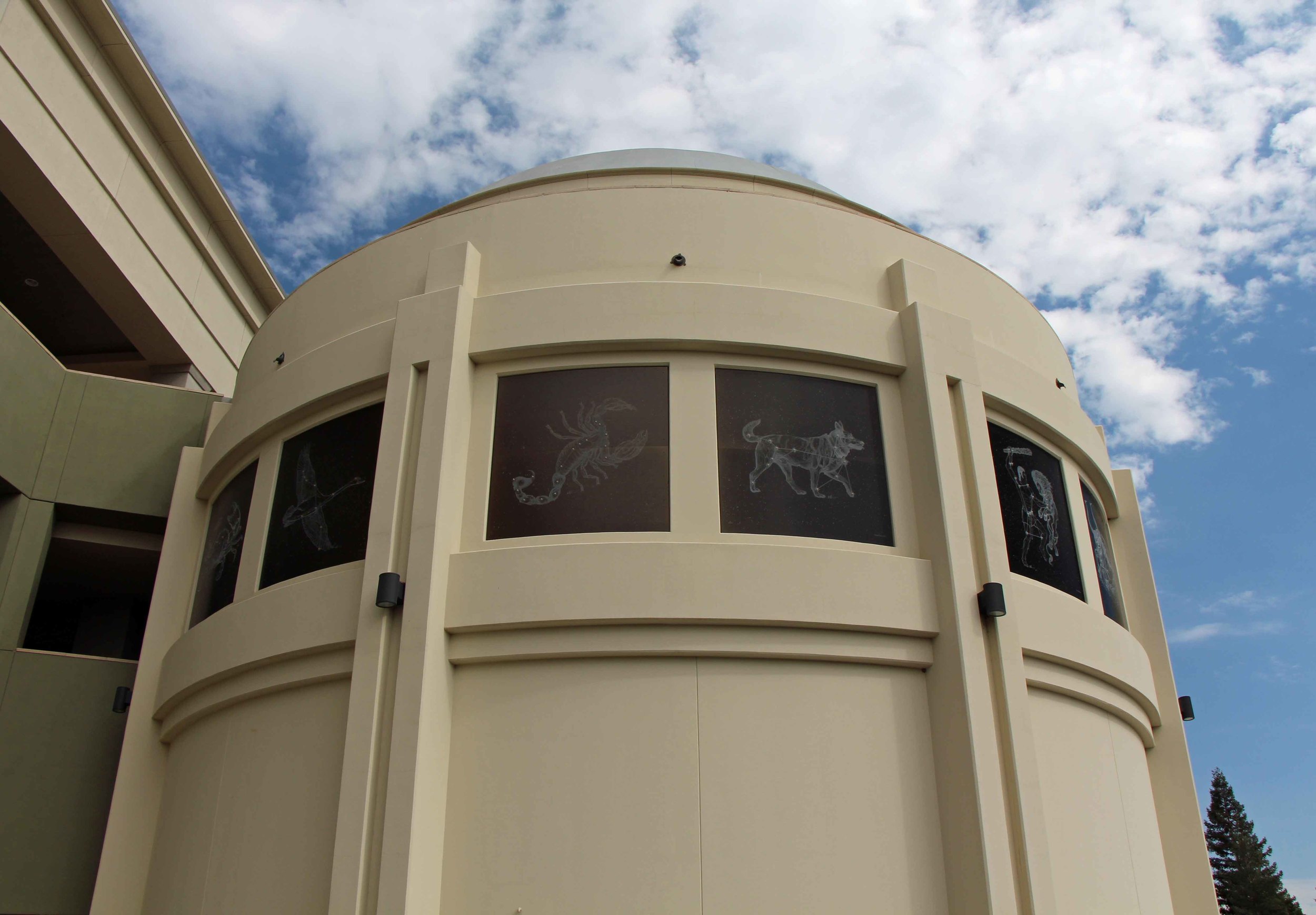
The outside of the planetarium is decorated with twelve large etchings on metal plates showing the stars that make up some of the best- known constellations. The stars are incorporated into images of the figures that the ancients associated with them.
Photo by Adam Blauert
Designed by MJC art professor Dr. Richard Serros, they depict the interaction of mythology, imagination, and early astronomy. The stars are represented by LED lights that are lit at night. You wouldn’t see them shine during a regular visit to the museum, but the museum hosts a “Science Night at the Museum” on the first Friday of every month during the fall and spring semesters (except January).
During these events, planetarium shows are offered, the museum’s exhibits are open, Science on a Sphere shows will be presented, and the MJC Astronomy Club offers free telescope viewings on the top level of the Science Community Center.
For more information about “Science Night,” call the museum at (209) 575-6196. If you go during the fall, winter, or spring, dress warmly so you can enjoy the telescope viewing and the museum’s outdoor exhibits.
Parking is free during these events.
The Great Valley Museum and Luebke Planetarium are part of the Community Science Center at Modesto Junior College’s West Campus, located at 2201 Blue Gum Avenue in Modesto. You can see it on the west side of Highway 99 as you drive through Modesto. To find it, exit Highway 99 at Carpenter Road/Briggsmore Avenue.
If you’re coming from Merced, turn left across the freeway on Carpenter Road. If you’re coming from the north, take the same exit, but turn right onto Carpenter. Either way, you’ll be on Carpenter for less than half a mile. From Carpenter, turn right on Blue Gum Avenue (right after you pass Collegiate Lane).
Photo by Adam Blauert
Turn right again in less than a half mile at the 4th Street stoplight. The parking lots are to the right and you should be able to spot the three-story museum building with its large planetarium dome to the left.
If you’re interested learning more about science, these additional locations are also highly recommended:
Wildlife Refuges – the ideal destination to follow a visit to the Great Valley Museum – especially exciting in the winter months when millions of migratory birds spend the winter in our valley. To combine a refuge visit with your trip to the Great Valley Museum, the closest refuge location is the viewing platform on Beckwith Road, about eight miles west of Modesto. For directions and more information, go to: http://www.fws.gov/refuges/profiles/index.cfm?id=81654. More extensive viewing opportunities are located at the Merced National Wildlife Refuge (birds) on Sandy Mush Road and the San Luis National Wildlife Refuge (birds and tule elk) on Wolfsen Road, north of Los Banos. For more information about these refuges, go to Merced County Events page about wildlife refuges.
Madera Fossil Discovery Center – a great place to learn about extinct creatures that lived in our Valley 800,000 years ago. For more information go to Fossil Discovery Center.
Applegate Zoo – the place to see local wildlife up close – including mountain lion, bear, bobcat, fox, and deer. There’s also a petting zoo and gift shop. For more information go to Merced County Events about Applegate Zoo.


Stanislaus National Forest

Stanislaus National Forest
Merced County is adjacent to two national forests. Flowing westward through the county, the Merced River forms the dividing line between Stanislaus National Forest and Sierra National Forest. Directly in the middle of the two forests is Yosemite National Park, the ultimate source of the river.
With the Merced River as a southern boundary, Yosemite National Park and the crest of the Sierra as an eastern boundary, the Calaveras/Amador County line as a northern boundary, and a rather erratic line through the foothills and lower pines as a western boundary, Stanislaus National Forest offers 898,099 acres for a wide variety of recreational activities.
It is a land that stretches from dense forests of tall pines and firs to sharp granite peaks; a land of meadows, lakes, rivers, wildlife, and wildflowers. In the winter, heavy snow transforms it into a great place for skiing, snowboarding, snowshoeing, snowmobiling, playing in the snow, and enjoying beauty and solitude.
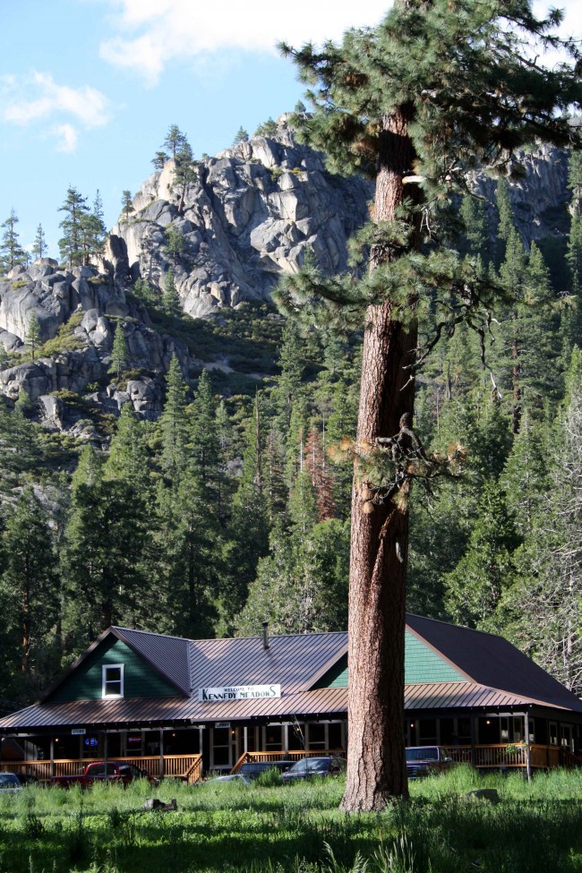
Photo by adam blauert Kennedy Meadows
Because the area is so diverse and offers so many recreational opportunities, there is often no clear answer to the question “What do you do there?” This article is an effort to answer that question and to provide a list of useful resources for learning about the forest and its recreational opportunities.
One of the best resources to start with is the annual visitor guide produced by Stanislaus National Forest is
Popular recreational activities within Stanislaus National Forest include
Auto touring
Visiting historic towns
Hiking and backpacking in wilderness areas
Hiking trails outside of wilderness areas
Camping
Ranger-led activities
Fishing
Boating
Swimming
Hiking and camping with dogs
Horseback riding
Mountain biking
OHV riding and exploring 4-wheel drive roads
Hunting
Downhill skiing
Playing in the snow
Cross-country skiing and snowshoeing
Snowmobiling

Stanislaus River photo by adam blauert
Within the forest there are many privately owned areas. Some of these offer additional recreational opportunities plus tent and RV campgrounds, lodging, restaurants, stores, and gas stations.
Ranger Stations
The Stanislaus National Forest Headquarters is located at 19777 Greenley Road in Sonora.
You can get general forest information and recreation permits by contacting the headquarters. The phone number is (209) 532-3671 and the general website for the entire forest is www.fs.usda.gov/stanislaus/.
The forest is divided into four districts which can provide more specific information about their respective areas:
Groveland District: 24545 Highway 120, Groveland – (209) 962-7825
Mi-Wok District: 24695 Highway 108, Mi-Wuk Village - (209) 586-3234
Summit District: #1 Pinecrest Lake Road, Pinecrest – (209) 965-3434
Calaveras District: 5519 Highway 4, Hathaway Pines – (209) 795-1381

Highway 108
Road Access and Auto Touring
Stanislaus National Forest is crossed west to east by Highways 120, 108, and 4. Anumber of secondary roads ranging from two-lane paved roads to rough four-wheel drive roads crisscross the forest. The major highways are worth driving simply to enjoy the views.
Major Towns, Supplies, Lodging, Food, and Gas
The major supply and service locations are adjacent to the major roads. Most of these towns have historic roots dating back to the 1800’s and are worth a visit in their own right. Especially historic and charming are Groveland, Jamestown, Sonora, Columbia, Twain Harte, Angels Camp, and Murphys.
Each of the major routes has chambers of commerce and/or business associations with websites for information about lodging, food, supplies, gas, local activities, and special events. I’ve listed them below in order from south to north:
Highway 120 ~ Big Oak Flat, Groveland, Buck Meadows, Mather
Highways 108 and 49 ~ Jamestown, Sonora, Columbia, Twain Harte, Mi-Wuk Village, Long Barn, Pinecrest, Strawberry, Dardanelle, Kennedy Meadows
Highway 4 photo by adam blauert
Highway 4 ~ Angels Camp, Murphys, Arnold, Bear Valley
www.ebbettspassadventures.com/
Wilderness Areas
Three wilderness areas are within or partly within the boundaries of Stanislaus National Forest. They offer some of California’s best hiking, backpacking, and fishing.
They are also great places to enjoy abundant and brilliant wildflowers and to see a variety of wildlife in its natural habitat.

Emigrant Wilderness Pack Trip photo by adam blauert
Emigrant Wilderness
The most popular wilderness area within the forest, the Emigrant Wilderness is adjacent to the northwest boundary of Yosemite National Park. Much of its popularity is the result of the terrain being somewhat less challenging than the steeper southern Sierra Nevada.
A land of low granite ridges with beautiful meadows and lakes, it is much like the northwestern part of the Yosemite Wilderness.

Columns of the Giants photo by adam blauert
Many remnants of volcanic activity can be seen, especially in the northeastern section. Although there are plenty of easier trails, you can also find many challenging routes that will take you far from any road.
The wilderness has a long human history and many of the lakes have been enlarged by small “check dams” that ensure a lasting water supply for grazing cattle through the summer.
Many of the meadows have been used as summer pasture since the 1800’s. Cattle are still often seen and remain a part of the living history of the area.
The lakes and streams provide some of the best fishing in the northern Sierra Nevada. There are several short backpacking and hiking destinations accessible from the western edge of the wilderness, but some of the most impressive destinations require trips of four days or more.
For more information go to: www.fs.usda.gov/recarea/stanislaus/recreation/recarea/?recid=15107
Carson-Iceberg Wilderness
Named for explorer Kit Carson who pioneered a trail through the area and for the Iceberg, a granite landmark located near the southern boundary of the wilderness, the western part is managed by Stanislaus National Forest and the eastern part by Humboldt-Toiyabe National Forest.
The Pacific Crest Trail traverses the eastern section. The terrain is rugged and steep, with fewer lakes than the Emigrant Wilderness. For these reasons this area sees fewer visitors, but provides excellent and challenging trails and options to find true solitude.
This is a great place to see remnants of the volcanic activity that shaped our state’s landscape.
For more information go to: www.fs.usda.gov/recarea/stanislaus/recreation/recarea/?recid=15109
Mokelumne Wilderness
Split among the Stanislaus, El Dorado, and Humboldt-Toiyabe National Forests, this area’s landscape is much like Carson-Iceberg.
Rugged, steep, volcanic, and without many lakes, it is still a place of great beauty where solitude may be found despite its proximity to Lake Tahoe. Located north of the Carson-Iceberg Wilderness, a long section of the 2,600 mile Pacific Crest Trail also passes through this area.
For more information go to: www.fs.usda.gov/recarea/ltbmu/recarea/?recid=11788.
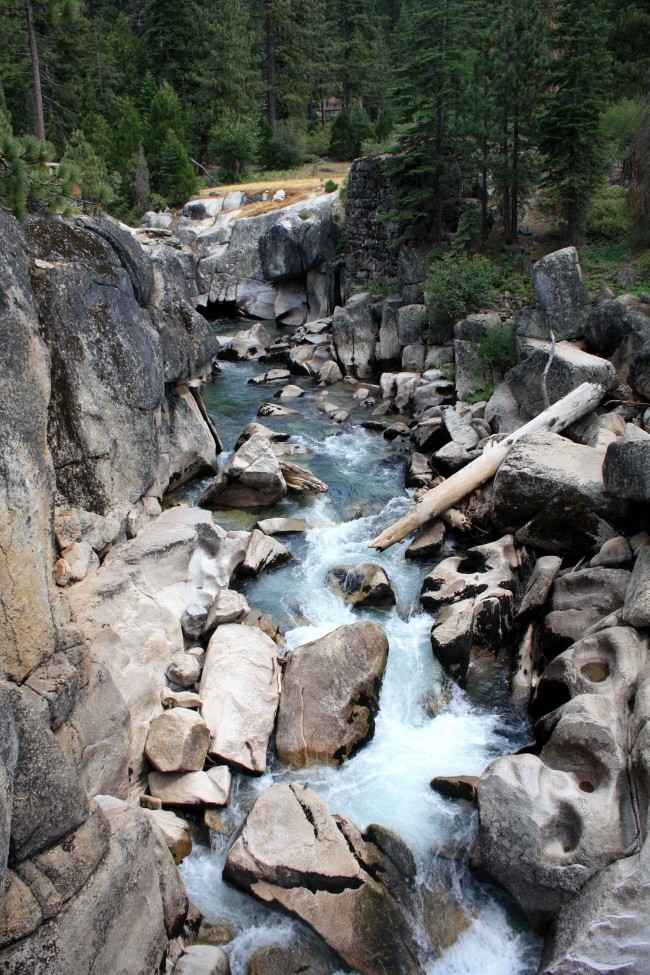
Stanislaus River photo by adam blauert
Trails Outside of Wilderness Areas
A number of excellent trails are found outside of the wilderness areas. Details can be found in some of the books listed below. You can also read some short descriptions at this site: www.fs.usda.gov/activity/stanislaus/recreation/hiking/?recid=14833&actid=50.
Books, Maps, and Other Resources
Although web-based resources are great for planning a trip, cellular service, internet, and electric power are hard to come by in much of the forest.
If you can store electronic resources on your device and have well-charged batteries, you may be able to continue to access your information this way. It’s always good, however, to have some paper resources. Print out information from the internet and bring both maps and books.
The general guide produced by Stanislaus National Forest is invaluable to have with you, especially if your plans change while on a trip. Weather and other elements outside of your control often require flexibility.
Books
Unfortunately there is no single book that comprehensively covers this area. For backpacking, Sierra North from Wilderness Press is a great choice.
For shorter day hikes, pick up a copy of California Hiking by Stienstra and Brown. Not only does this book highlight the best day hikes in Stanislaus National Forest, it is also an excellent resource for the entire state with a total of 1,000 hike routes.
Emigrant Wilderness published by Tom Harrison Maps Carson-Iceberg, Emigrant, and Mokelumne Wilderness Areas published by National Geographic The Forest Service also publishes separate maps for each wilderness area For more detailed hiking maps, check the USGS website for 7.5 and 15 minute sections. You can order printed copies of these maps or download free electronic copies.
Maps
It’s good to have a general highway map, but if you plan to explore off the main roads the Stanislaus National Forest Map is one of the most important things to have with you. In addition to roads and trails, it also shows campgrounds, ranger stations, supply locations, and recreation areas. It supplements the general guide to the forest (see above).
For some reason it is hard to find on the internet. Your best source is the website of the U.S. Geological Survey where you can buy it for $12: store.usgs.gov.
You can also purchase it at a ranger station.
For hiking or backpacking, the following maps are the top choices:No matter what resources you use, always call a ranger station to verify current conditions before you leave on a trip.
Conditions are always changing and even the official websites can be badly out of date.
Campground Camping
Within Stanislaus National Forest you’ll find 47 campgrounds.
You can also find a complete listing at: www.fs.usda.gov/activity/stanislaus/recreation/camping-cabins/?recid=14833&actid=29.
Some campgrounds are reservable in advance. You can search for reservable campsites by going to: www.recreation.gov.
Dispersed Camping
Camping outside a campground (usually referred to as “dispersed camping”) is permitted in areas of the forest where signs do not specifically prohibit it.
You can always check with a ranger station before you set up camp. In order to have a campfire you need a California Campfire Permit, available at any ranger station. You can also take an online quiz and get one issued electronically by going to: www.fs.fed.us/r5/sequoia/passespermits/campfire_permit/campfire-index.html.
As long as you follow the rules on the permit and make sure that you have chosen a safe site, your campfire is legal. Before your trip you should also make sure that additional campfire restrictions have not been put in place.
In dry years campfires are sometimes prohibited outside of established campgrounds.
Ranger-Led Activities
A variety of programs and hikes for all ages and ability levels are offered throughout the year. You can find up-to-schedules for each ranger district at: http://www.3forests.us/stanislaus.
Fishing: The forest abounds with streams, rivers, natural lakes, and reservoirs. Many are stocked and most are open to fishing. For regulations and stocking information, go to www.dfg.ca.gov.
Tom Stienstra’s California Fishing is a good general guide to the whole state, including Stanislaus National Forest.
Boating: Motorized fishing boats area allowed on the following lakes: Alpine, Beardsley, Cherry, Pinecrest, Spicer (in the half of the lake within Tuolumne County, but not in the Alpine County half), and Union. Water skiing and jet skis are allowed at Beardsley and Cherry.
Swimming: Swimming is allowed in most streams, rivers, and lakes, however it can be dangerous. Make sure that all people in your group have strong swimming abilities and you have flotation devices in case a rescue is necessary. Check with a ranger for current conditions. Generally Pinecrest Lake is one of the safest easily-accessible swimming destinations. Cherry Lake is also a good choice.
Dogs
Dogs are welcome on trails and in campgrounds in national forests as long as they are on-leash and well-behaved. They are not permitted on trails in state or national parks. Dogs may be off-leash as long as they are under voice control within wilderness areas (except in the Carson Pass Management Area of the Mokelumne Wilderness).
Horses
Horses are permitted on trails within the national forest. For overnight trips they must be included on your wilderness permit. Check with the ranger station for the best trail parking for horse trailers. Day rides and overnight pack trips are offered by:
Kennedy Meadows Pack Station: www.kennedymeadows.com/
Aspen Meadow Pack Station: aspenmeadowpackstation.com/
Leavitt Meadows Pack Station: www.leavittmeadows.com/
If you are not up to carrying all your gear or if you want to enjoy the wilderness with in a less strenuous way, a pack trip is a good choice.
Mountain Bikes
All roads and most trails outside of wilderness areas are open to mountain bikes. Check with a ranger for recommended trails and roads. Ann Marie Brown’s Northern California Biking is an excellent resource.
Off-Highway Vehicles and 4-Wheel Drive Vehicles
Many remote forest roads require 4-wheel drive and several areas are open to off-highway vehicles. For more information go to: www.fs.usda.gov/activity/stanislaus/recreation/ohv.
A copy of the Stanislaus National Forest map is extremely helpful in locating the best sites.
Hunting
The forest, including wilderness areas, is open to hunting according to DFG regulations. You can check regulations at www.dfg.ca.gov. Target shooting is prohibited in wilderness areas.
Winter Activities
Some roads and campgrounds are open through the winter months, especially in the lower elevations. Always carry tire chains and know how to install them. Highway 4 closes at the Bear Valley road junction and Highway 108 closes beyond Strawberry after the first major snowfall. Many lodging facilities are open year-round.
Downhill skiing and snowboarding
Offered at Dodge Ridge (Highway 108 at Pinecrest), and Bear Valley (Highway 4 near Lake Alpine). For more information:Snow Play Areas: Stanislaus National Forest is also a popular destination to play in the snow. Three “Sno-Parks” offer snow recreation for a $5 use fee.
You can find more information at: www.ohv.parks.ca.gov/pages/1233/files/sno-parks_2008-09.pdf.
Permits must be purchased before you reach the Sno-Park. Look for signs as you drive up Highway 108 or Highway 4 or call the ranger station for a current listing.
Snowshoeing and cross-country skiing
Along trails is also popular. Occasionally ranger-led snow activities are offered. Check with the ranger station for details. If none are offered, try Yosemite or Sequoia National Parks.
To find your own route, pick up a copy of Best Snowshoe Trails of California by Mark White. www.dodgeridge.com/sitewww.bearvalley.com
Snowmobile Trails
For snowmobiling information go to www.fs.usda.gov/activity/stanislaus/recreation/wintersports/?recid=14833&actid=92 or call the ranger station.


Turlock Museums

Photo by adam blauert
Museums in the Valley
Although part of Stanislaus County, Turlock is only 25 miles north of Merced – closer than some other towns that are within the county. Just like Merced, the core of Turlock was laid out by the Southern Pacific Railroad as it built southwards through the Central Valley in the early 1870’s.
The town had a slow start, finally taking off after the Turlock Irrigation District built canals to provide Tuolumne River water for irrigation. Large tracts of land were bought up by land companies and subdivided as “colonies” – the “colonists” could buy the land on credit and pay off part of the loan after each year’s harvest.

THS Entrance - PHOTO BY ADAM BLAUERT
History of the Central Valley
I grew interested in the town’s history after reading the following in Garden of the Sun, a history of the Central Valley written by Fresno State Professor Wallace Smith in 1939:
A pioneer wheat grower in that region asserted that the sand drifted against the stables in such high piles that pathways had to be shoveled before stock could be taken out.
The board fences used in the early days often broke from the weight of the sand piled against them by the winds surging through the passes in the Coast Range mountains.
Grasshoppers
Then came the grasshoppers. They were hatched in April, they appeared in full bib-and-tucker in May, they defoliated the vineyards and orchards in June, and only the bare peach pits, glistening like gnawed bones, were left on the trees in July.

THS Front - PHOTO BY ADAM BLAUERT
In 1904 an indignation meeting was held at Hilmar to protest against the alleged misrepresentations of the advertisements and circulars which had been sent out to prospective colonists.... But eventually the grasshoppers were destroyed by grass fires, night fires, and hopperdozers; water demonstrated the wonderful fertility of the apparently sandy soil; and homes were erected. (2nd edition, pp. 596-597)
My great-grandfather settled in Turlock just 10 years after the time described in Smith’s history, so I grew curious about learning more.
What drew him to Turlock? What were conditions like in 1914?
The next time I drove up to Turlock I made a stop at the Turlock Historical Society’s museum.
Historic Storefront
Located in a historic storefront at 108 S. Center Street, it is open Tuesdays and Thursdays from 11AM to 3PM. Admission is free and friendly volunteers are on hand to answer questions.
For more information go to: http://turlockhistoricalsociety.org/
or call (209) 668-7386.
The museum has an interesting collection of artifacts and antiques that illustrate the town’s development, life in the previous century, and the many peoples and cultures that came from around the world to settle in this area.
In addition to what I learned from the displays, I am continuing to learn more as I read a local history that I bought while at the museum: Streams in a Thirsty Land – A History of the Turlock Region.
Carnegie Arts Center in Turlock
If you make the trip up to Turlock, make sure you also plan to visit the Carnegie Arts Center at 250 North Broadway.
CAC 1916 Building - PHOTO BY ADAM BLAUERT
Originally established as one of Andrew Carnegie’s philanthropic enterprises to spread education, the library was built in 1916.
Nearly 150 Carnegie libraries were built in California during the early 1900’s. In 1968 the books were moved to a larger building and the former library was converted into a recreation and arts center.

CAC Old and New - PHOTO BY ADAM BLAUERT
While being renovated and expanded in 2005 it was gutted by fire.
Overwhelming community support made possible the restoration of the building and the addition of an 18,000 square foot exhibit, classroom and office space. Regular art classes are offered for all ages, though the biggest attractions for visitors from outside the county are the frequently-changing world-class art exhibits.
Admission is $5/person and the Arts Center is open Wednesday-Sunday from 10AM to 5PM.
For more information about the Carnegie Arts Center go to http://www.carnegieartsturlock.org
or call (209) 632-5761.

Calaveras Big Trees

Photo by adam blauert
The wonder of the Big Trees
A shady grove of giant sequoias is a great place to be during the hot months of summer. Naturally-occurring populations of giant sequoias – scientific name Sequoiadendron giganteum, also known as Sierra redwoods – are found only along the western slope of our Sierra Nevada mountains.
These massive trees can grow to be over 300 feet tall and 100 feet in circumference, and can live for as many as 3,500 years.
Out of about 70 total groves of these amazing trees, only 9 are located north of the Kings River. Close to home, Yosemite’s spectacular Mariposa Grove is probably the best-known, with 500 mature sequoias.
During the summer it can be enjoyed on foot or by taking one of the tram tours offered by the park. Two smaller groves within the park, the Merced and the Tuolumne, are accessed from easy trails along the Tioga Road (Highway 120).
Highway 4
Another great place to see sequoias is Calaveras Big Trees State Park, located four miles east of Arnold on Highway 4. Distance-wise, the drive from Merced is only about 10 miles longer than the drive to Yosemite’s Mariposa Grove.
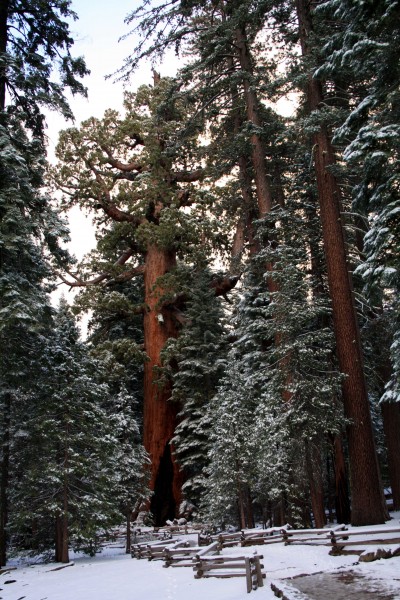
Mariposa Grove Grizzly Giant Photo by adam blauert
While Yosemite’s Mariposa Grove is a must-see while you’re in Yosemite, one of the disadvantages is that you can’t actually camp there. At Calaveras Big Trees, you’ll find 74 comfortable sites with flush toilets and coin-operated showers right next to the North Grove.
Camping in the Big Trees
The campground is so close to the grove that you can start your hike through the trees directly from your campsite. An additional 55 sites are located at Oak Hollow, halfway between the two groves.
A small number of more primitive “environmental campsites” are also available throughout the park.
The campsites at Big Trees are often much easier to book than sites within Yosemite.
The North Grove is one of two groves that make up the park. Located on the north side of North Fork of the Stanislaus River, it is the most popular of the two.
Much of this is due to the fact that the trail is accessible to just about everyone – wheelchairs and strollers are commonly seen – and you can see a lot in an easy 1.5 mile loop.

Discovery Tree Stump - PHOTO BY ADAM BLAUERT
Big Stump
One of the most memorable landmarks along the trail is the “big stump,” of the “Discovery Tree.” Cut down in the 1850’s, the stump was sanded smooth and used as a dance floor.
Today’s guests can stand on it to get an idea of just how massive these trees can be.

Pioneer Cabin Tree - PHOTO BY ADAM BLAUERT
Tunnel cut through a Big Tree
Further along the trail, the “Pioneer Cabin Tree” has a tunnel cut through it and is one of the most photographed trees in the park.
The trees of this grove were the first giant sequoias discovered by European-American settlers that the general public came to know about.
They immediately became a popular tourist destination.
The South Grove is located on the opposite side of the Stanislaus, a few miles down the Walter W. Smith Memorial Parkway.
Hiking
For a longer hike, this grove’s 5-mile loop trail will satisfy. Along the way you’ll see the Agassiz Tree, the park’s largest. 262 feet tall and almost 100 feet in circumference, it is an amazing sight.
A number of longer trails and unpaved fire roads connect major parts of the park, allowing longer hikes.
For a different landscape, try the 2.5 mile Lava Bluffs Trail above the river.
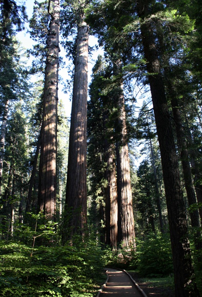
Calaveras Sequoias - PHOTO BY ADAM BLAUERT
In addition to hiking and camping, the park provides picnic areas and the river is open to fishing and swimming.
Day use is $8 a car
As a day trip or overnight camping destination, it is a great place to escape the summer heat.
It’s also a great place to visit year-round. The campground is open from March through November and the trails stay open in the snowy months for snowshoeing and cross-country skiing.
The park provides a safe place for kids to play in the snow. During a winter visit you can warm-up in the warming hut located at the North Grove.
In the fall maples, dogwoods, and shrubs can provide dramatic fall color among the evergreen sequoias, pines, and firs.
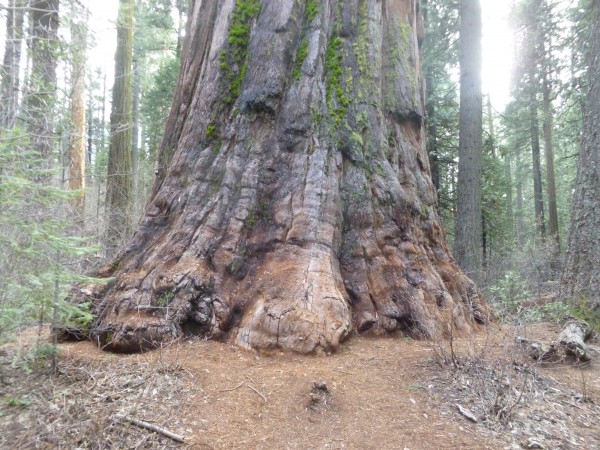
PHOTO BY ADAM BLAUERT
More information
The park’s website provides a lot of useful information for planning a trip.
Go to http://www.parks.ca.gov/?page_id=551
for more information or call the park at (209) 795-2334.
To book a campsite reservation, go to http://www.reserveamerica.com/
or call 1-800-444-7275.
Campsites are $35 a night and can accommodate recreational vehicles.

Oakdale Cowboy Museum

PHOTO BY ADAM BLAUERT
Ranching continues today
Ranching has always been a big part of the economy and culture of central California. Started in the 1700’s when the Spanish drove the first cattle into the state, ranching continues today on thousands of ranches of throughout the state.
Poorly suited for irrigation and constrained by the state’s limited water resources, California’s dry hills abound with native grasses and provide an ideal range for cattle.
Because the state is dry so much of the year, ranches tend to be large with each head needing many acres to satisfy its grazing needs.
“Cowboy Capital of the World.”
Ranching life in California has generally followed the pattern of ranching life in other western states – with social gatherings centered around ranch work and competitions of skill – roundups, brandings, county fairs, and especially rodeos. Starting in the 1950’s, Oakdale began to establish itself as “Cowboy Capital of the World.” The town has a rich western heritage including not only the big rodeos of the last 60 years, but also a ranching history dating back to the 1850’s.
Oakdale Cowboy Museum
Much of this history is displayed and celebrated at the Oakdale Cowboy Museum. Located in downtown Oakdale’s old train station, the museum contains interesting collections of rodeo memorabilia, saddles, tack, ranching tools and implements, and historic photographs.
Permanent exhibits feature local cowboys who won big in the arena and local ranchers whose operations have been handed down from generation to generation since the early days of the county.
Although the museum isn’t especially large, there’s plenty to see and the volunteers on duty are helpful and knowledgeable. The first room contains permanent exhibits and a small gift shop.
The museum has published a number of books of local history that are available for purchase. The second room contains both permanent and temporary exhibits. The current temporary exhibit features the tools and techniques of saddle-making.
Other recent temporary exhibits have focused on the bronze cowboy sculptures of Jo Mora and the iconic stone fences and corrals of the local foothills.

Museum - PHOTO BY ADAM BLAUERT
The Oakdale Rodeo on the second weekend of April each year and the museum sponsors several special events annually. Check the museum’s website or call for more information.

Exhibits - PHOTO BY ADAM BLAUERT
Hours
The museum is open from 10AM to 2PM Monday through Saturday, except major holidays. If you are curious to learn more about the ranching and rodeo heritage of Central California, this is a great place to start.
No matter what your level of knowledge and/or experience with western lore, you’ll learn something here.

Branding Irons - PHOTO BY ADAM BLAUERT
The cowboy statue in front of the museum is a popular backdrop for photos.
About an hour’s drive from many towns in Merced County, Oakdale is an easy stop on the way to Sonora, Columbia, or Jamestown.
For more information
go to http://www.oakdalecowboymuseum.org/index.html
or call (209) 847-7049.
The museum is located at 355 East F Street, in Oakdale, across from the historic H-B Saloon.

McHenry Mansion and Museum

Photo by Adam Blauert
Mansions in the valley built by the same brothers in law
On the corner of M Street and West North Bear Creek Drive in Merced stands the Hooper House Bear Creek Inn (http://www.hooperhouse.com/index.html). This large colonial style home was constructed in 1936 to replace the Huffman Mansion, which burned in 1933.
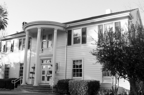
Hooper house
Merced’s Huffman Mansion was a near twin of Modesto’s McHenry Mansion. The homes were built by brothers-in-law Charles Huffman and Robert McHenry in 1883.
Both men prospered from the development of the Central Valley and its irrigation systems. Charles Huffman acquired land for the Southern Pacific Railroad’s route through the Central Valley and selected the townsite of Merced.
Huffman and McHenry’s 10,000 square foot mansions were the largest and most extravagant homes in the area.

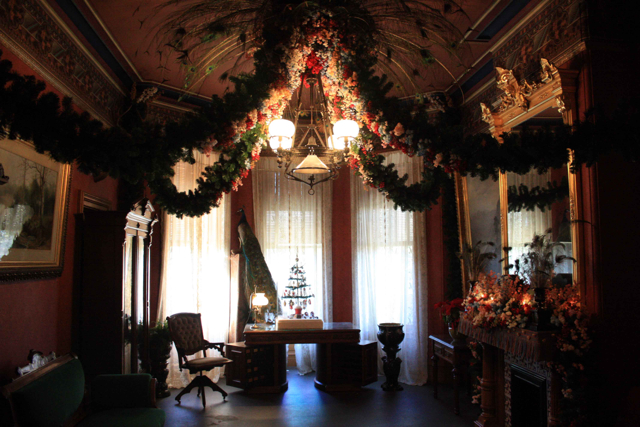
McHenry Dining Room - photo by adam blauert
Gallo Foundation
Although Huffman’s house burned, McHenry’s house was saved from demolition by the Gallo Foundation and donated to the City of Modesto in the 1970’s.
It was completely restored and was opened to the public in 1983. It remained open until December of 2011 when it was nearly lost in a fire. A vigilant neighbor and Modesto’s firefighters saved it from total destruction.
Over the past year a second meticulous restoration has removed the signs of damage – much of which was caused by the house’s fire sprinklers. Furniture and art have been cleaned and restored. Wallpaper has been replaced with detailed reproductions of the original patterns.
The mansion is open for tours while the final repairs are being made. When I visited in December, one of the few things remaining was the replacement of the carpeting.
The floor coverings are currently being reproduced by the British factory that made the original ones purchased by Robert McHenry.
The McHenry Mansion is the best-preserved and largest Victorian mansion in Central California that is open to the public (outside of the Bay Area).
Free Admission
Admission is free and you can join a tour Sunday through Friday between 12:30 and 4PM. Tours last at least an hour and are led by docents who are experts about the time period recreated in the mansion (1883-1906).
McHenry Museum photo by adam blauert
On our recent tour I learned several new things about life and technology in the Victorian Era, despite having previously toured a number of other homes from the same time period. I was impressed by the success of the restoration.
The interior of the house is close to sparkling like it did on the day it was completed. When the carpet is installed (planned for spring 2013) the effect will be complete.
The mansion is located at the corner of 15th and I Streets in Modesto.
Tours start at the Visitor Center and Gift Store – two doors down from the mansion at 924 15th Street. A ten-minute video shown prior to tours does a great job of introducing the time period and telling the story of the McHenry family.
It is illustrated with an extensive collection of historic images. If you’re looking for unique gifts or special Christmas ornaments, the Gift Store has a nice selection.
McHenry Office - PHOTO BY ADAM BLAUERT
All proceeds go to the McHenry Mansion Foundation and its work to maintain this special house.
For more information
To learn more about the mansion, the McHenry family and the early years of Modesto, pick up a copy of Colleen Stanley Bare’s The McHenry Mansion: Modesto’s Heritage. Bare has also written an excellent book about the Huffman family of Merced and their mansion: Pioneer Genius: Charles Henry Huffman.
For more information go to www.mchenrymansion.org/mansion or call (209) 652-7190.
The mansion is decorated for Christmas every year and the garden may be rented for parties, receptions, and weddings.
A regularly-updated event calendar may be found at: http://www.mchenrymansion.org/events.html
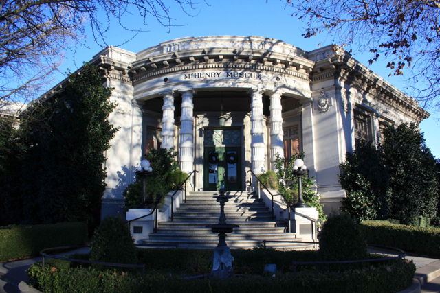
Located nearby at 1402 I Street is the McHenry Museum. A vast collection of Stanislaus County historical exhibits and photographs are housed in a former library building that was built for the City of Modesto by the McHenry family in 1912.
The museum is open Tuesday through Sunday from 12 to 4PM. Due to the size of the museum’s collection and the length of the tours offered at the McHenry Museum, it is difficult to visit both the mansion and the museum on the same day. It is best to plan two separate trips.
For more information about the museum, go to www.mchenrymansion.org/museum
or call (209) 577-5235.
Other historic homes within an hour’s drive of Merced that offer tours include:

Turlock Lake State Recreation Area

Turlock Lake State Recreation Area
Less than an hour from many points in Merced County, Turlock Lake large and easily accessible.
Location
Lake Road (accessed from Highway 132) between Waterford and La Grange Distance from Merced: 32 miles Distance from Los Banos: 67 miles Operating authority: California State Parks Surface area of lake: 3,500 acres
Facilities and activities
Boat ramp
Flush restrooms
Drinking fountains
Campgrounds with BBQ grills/fire rings, hot showers
Picnic areas with tables, shelters, and BBQ grills
Swimming beach
Short hiking trails
Dogs allowed? Yes
Horses allowed? No
Hunting allowed? No
Fish species: bass, bluegill, catfish, crappie, trout
Boat rentals: No

Modesto Reservoir Regional Park

Modesto Reservoir Regional Park
Popular with residents of Modesto and Turlock, this park is surprisingly close to Merced and offers a lot of recreational opportunities and facilities.
Location
Reservoir Road (accessed from Highway 132) between Waterford and La Grange.
Distance from Merced: 37 miles
Distance from Los Banos: 51 miles
Operating authority: Stanislaus County Parks and Recreation
Surface area of lake: 2,800 acres
Facilities and activities
Boat ramp, marina
Concessions booth
Flush restrooms
Drinking fountains
Campgrounds with BBQ grills/fire rings, RV hookups
Picnic areas with tables, shelters, and BBQ grills
Group picnic areas and shelters
Swimming area
Wildlife viewing area
Archery range
Radio-control airplane flying
Dogs allowed? No
Horses allowed? No
Hunting allowed? Yes
Fish species: Bass, trout
Boat rentals: No
Website: http://www.co.stanislaus.ca.us/er/parks/
Recreation organizations
The Mid-Valley Water Ski Club holds events throughout the year for people of all ages and abilities. http://www.midvalleywaterskiclub.com/ for more information.
The Yahi Bowmen Archery Club operates the reservoir’s archery range. Guests are welcome and regularly-scheduled activities are offered for people of all ages and abilities. https://www.facebook.com/YahiBowmenModesto for more information.
Adam Blauert, a high school teacher and avid outdoors enthusiast, has dedicated the majority of his life to Merced County. His passions include fishing, backpacking, delving into local history, and exploring the wonders of the western states.