

San Luis Reservoir Area

O’Neill Forebay, Los Banos Creek Reservoir-Part of both the California Aqueduct and the Central Valley irrigation projects.

San Luis Reservoir
San Luis State Recreation Area
San Luis Reservoir, O’Neill Forebay, Los Banos Creek Reservoir: The San Luis San Luis Reservoir, O’Neill Forebay, Los Banos Creek Reservoir-Part of both the California Aqueduct and the Central Valley irrigation projects.
Three Units
State Recreation Area is made up of three units. San Luis Reservoir is the largest and is used primarily for fishing. Part of both the California Aqueduct and the Central Valley irrigation projects, it is the largest off-stream reservoir in the United States.
At full capacity, it measures nine by five miles at its widest points.

O'Neill Forebay
O'Neill Forebay
The O’Neill Forebay, a smaller lake below the San Luis Dam, is open to all kinds of recreation and offers the best fishing in the area.
Although this area can be windy, the O’Neill Forebay is more sheltered than the San Luis Reservoir. O’Neill Forebay is considered to be one of California’s premier fishing areas.
The State record striped bass was caught in O’Neill Forebay in 2008. It measured 52.5 inches and weighed 70.6 lbs.
Los Banos Creek Reservoir
Located a few miles to the south, receives much less visitation. It is best-known for springtime ranger-led hikes along the creek in the spring.
With a 5mph speed limit, Los Banos Creek Reservoir is Los Banos Creek primarily enjoyed by anglers.
A shoreline trail is provided for fishing access.

Los Banos Creek
Location
San Luis Reservoir and the O’Neill Forebay are located on Highway 152, a few miles west of I-5. Additional access is available from State Highway 33.
Los Banos Creek Reservoir is located on Canyon Road, southwest of Los Banos and I-5.
Distance from Merced
San Luis Reservoir and O’Neill Forebay: 48 miles
Los Banos Creek Reservoir: 42 miles
Distance from Los Banos:
San Luis Reservoir and O’Neill Forebay: 12 miles
Los Banos Creek Reservoir: 6 miles
Operating authority: California State Parks
Surface area of lake: San Luis Reservoir 12,700 acres
O’Neill Forebay 2,250 acres
Los Banos Creek Reservoir 623 acres
Facilities and activities
Boat ramp
Chemical/flush restrooms
Drinking fountains
Visitor center
Campgrounds/group campgrounds with BBQ grills/fire rings, shelters, hot showers
Picnic areas with tables, shelters, and BBQ grills
Group picnic areas and shelters
Swimming beach/area with showers
Dump station
Hiking trails (additional trails available in the adjacent Pacheco State Park)
Wildlife viewing areas
OHV recreation area (south side of Highway 152 at Jasper-Sears Road. Novice-level trails for both green and red sticker vehicles are provided)
Dogs allowed? Yes
Horses allowed? Yes, and many equestrian trails are available at the adjacent Pacheco State Park.
Hunting allowed? Yes
Fish species:
San Luis Reservoir and O’Neill Forebay: bass, bluegill, crappie, perch, shad
Los Banos Creek Reservoir: bass, bluegill, catfish, and crappie. Trout are stocked in the early spring, but don’t last through the summer because of water temperatures.
Boat rentals: No
For More information and special events
Website: http://www.parks.ca.gov/?page_id=558
O’Neill Forebay hosts a Kids Fishing Day in the spring. The popular Path of the Padres is a Ranger-led hike along Los Banos Creek that is offered from February through April.
Hikers enjoy a creekside walk through wildflowers and learn about the history, wildlife, and plant species of the area.
Nearby parks
Pacheco State Park is adjacent to San Luis Recreation Area and offers hiking and equestrian trails. Ranger-led wildflower hikes are offered in the spring.
The California Aqueduct Bikeway begins at San Luis Creek and goes 70 miles north to the Bethany Reservoir State Recreation Area with rest stops ten miles apart and chemical toilets
San Luis Reservoir, O’Neill Forebay, Los Banos Creek Reservoir-Part of both the California Aqueduct and the Central Valley irrigation projects.
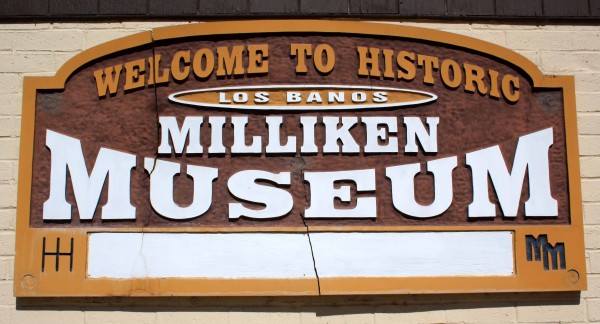
Milliken Museum and Los Banos Historic Sites

Photo by adam Blauert
Treasure trove of artifacts
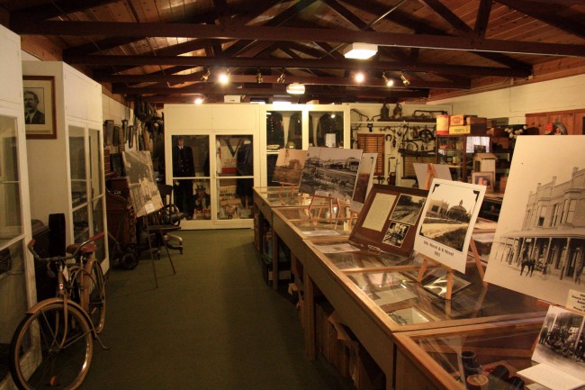
With people, it’s what’s on the inside that counts. The same is true for museums. Los Banos’ Milliken Museum may look like a 1960’s era elementary school building on the outside, but inside you’ll find a treasure trove of artifacts and history.

Milliken Museum 4 Miller Buggy PHOTO BY ADAM BLAUERT
Want to see evidence of some of the species that lived here in prehistoric times or artifacts from the Native Americans who first settled our valley?
Want to know more about Henry Miller who led the development of the Westside’s agriculture and the town of Los Banos? Interested in seeing photos of destruction in Los Banos caused by the 1906 San Francisco Earthquake? Do you enjoy learning about the technology of home, business, farm, and community life in the past century?
Milliken Museum PHOTO BY ADAM BLAUERT
If you answered “yes” to any of the above, then you’ll probably enjoy a visit to the museum.
Having not visited in several years, I stopped in a couple of months ago. The museum has recently reopened following a transfer of the building’s ownership and some necessary repairs that kept it closed through the winter.
Ralph Leroy Milliken
Local farmer, mail carrier, and historian Ralph Leroy Milliken started the museum’s collection in 1954 with documents, artifacts, and oral histories. He served as the museum’s curator until his death in 1970.
In recognition of his pioneering effort, the museum has renamed for him.

Milliken Museum PHOTO BY ADAM BLAUERT
Today, enthusiastic volunteers staff the museum and carry on the tradition that he began.
For those who want to learn more about local history, the museum sells several books written by Milliken and other local historians.
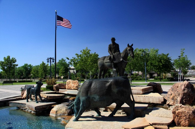
Statue of Henry Miller
Allow at least an hour to appreciate the museum’s collection. While you’re in Los Banos, don’t miss the statue of Henry Miller located at 6th and H Streets.
Henry Miller Statue PHOTO BY ADAM BLAUERT
You can then walk or drive around the area between H Street and Highway 152.
This is Los Banos’ historic downtown and there are many interesting old buildings to see. If you’re hungry there are plenty of places to get a bite to eat including the legendary Wool Growers Basque Restaurant, a Westside institution for 120 years.
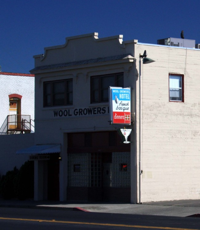
Wool Growers Restaurant PHOTO BY ADAM BLAUERT
The name comes from the work of sheepherding done by many of the early Basque settlers of the county. Hearty multi-course meals are served family-style in a dining room that has hardly changed in 50 years.
It’s the perfect place to end a “history trip.” Just don’t forget to bring cash as it is the only form of payment accepted at Wool Growers. If you’re looking for something else to complete your trip, stop by the nearby San Luis National Wildlife Refuge to see tule elk and waterfowl.
Near the refuge entrance you’ll see the Camp San Luis Adobe, the oldest intact building in Merced County.
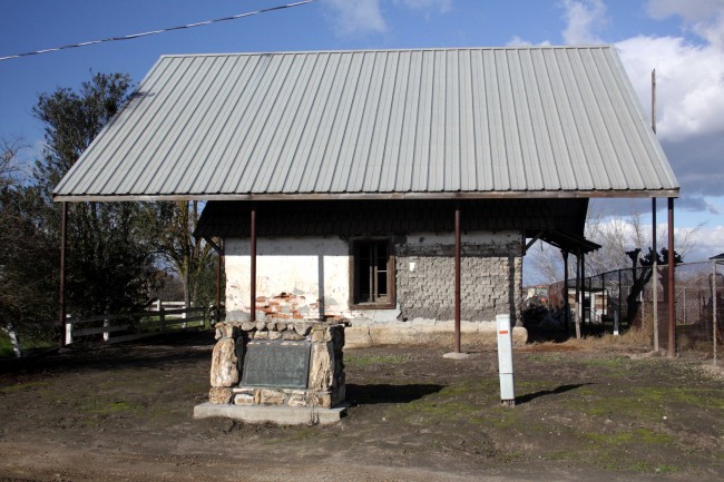
San Luis Camp Adobe PHOTO BY ADAM BLAUERT
Location and for more information
Built in 1848 by Francisco Perez Pacheco, the one-room house is now protected by a metal superstructure. The refuge is located north of Los Banos on Wolfsen Road.
The Milliken Museum is located adjacent to Los Banos County Park along Highway 152 (Pacheco Boulevard) between 7th and 9th Streets in Los Banos.
The park is also often known as “Pacheco County Park.” You can park in the parking area on Pacheco Boulevard or behind the museum on Washington Avenue.
For more information, call the museum at (209) 826-5505 or go to http://www.ourlosbanos.com/millikenmuseum.html.
The museum is open 1-4PM Tuesday through Sunday.

San Juan Bautista

PHOTO BY ADAM BLAUERT
Central Valley and the Merced river
In 1806 a Spanish expedition into the Central Valley identified the Merced River as the most likely site for the first inland mission settlement. The recommendation was never acted upon because of the hostility of the valley’s Native American tribes.
Although the original inhabitants of California had often been friendly to the Spanish during their first contacts, many tribes became more wary as disease spread, land was lost, and those who came to live at the missions were not allowed to leave.
Many natives who fled the mission life ended up joining valley and foothill tribes beyond the active control of the Spanish.Although a number of land grants were made in the Valley after Mexico rebelled from Spain in 1821, there was never very much Spanish or Mexican settlement.
In Merced County, the San Luis Gonzaga, Santa Rita, Orestimba, and Panoche grants were the only permanent settlement sites in the 1840’s.

Plaza Hall - PHOTO BY ADAM BLAUERT
San Juan Bautista, in San Benito County
The closest town and closest mission of any size were located at San Juan Bautista, in modern San Benito County.
50 miles west of the current town of Los Banos, the mission was close enough to the valley that padres traveled along Los Banos Creek to recruit and/or capture natives to come to the mission.
“Path of the Padres” hike
The annual “Path of the Padres” hike offered by California State Parks at Los Banos Creek Reservoir gives hikers a chance to retrace part of this route and to learn more about California’s early history. This hike is offered from February through April each year.
Call (209) 826-1197 at the beginning of the year to make reservations. Or website:
http://www.parks.ca.gov/Events/EventDetail.aspx?id=5098
Today, San Juan Bautista is one of the best-preserved remnants of Spanish and Mexican California. It is a town that time has nearly forgotten, with a current population of less than 2,000.
Historic buildings dating from 1797 to the mid 1800’s surround three sides of the town’s plaza. The third side is open to the fertile San Juan Valley, with productive farmland stretching to the edge of the mountains.

Plaza Hotel - PHOTO BY ADAM BLAUERT
San Juan Bautista’s plaza
The only town center in California where all of the buildings date back to the mid-1800’s or before.
The Plaza Hotel, Castro-Breen Adobe, Plaza Hall and Plaza Stable have been restored to the way they would have been then and are open to the public as part of San Juan Bautista State Historic Park.
Hours
Closed on Mondays and holidays, they are open from 10AM to 4:30PM Tuesday-Sunday. There are few other places in California where it is so easy to imagine the 1840’s, when California was still a province of newly-independent Mexico.
It’s a great place to learn about California’s history.
For more information go to: http://www.parks.ca.gov/?page_id=563.

Mission Church - PHOTO BY ADAM BLAUERT
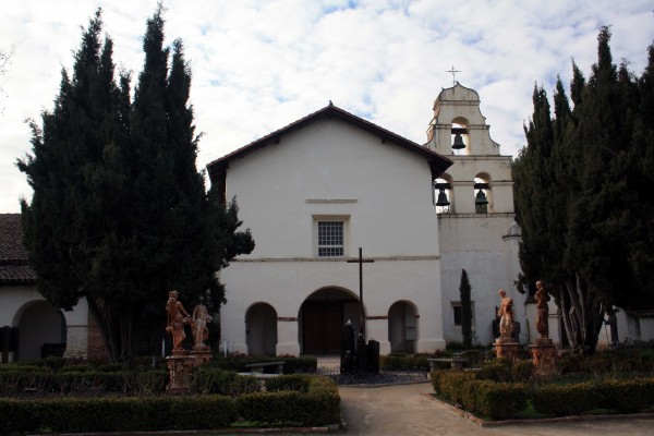
Active Church
The mission is still an active church but is open to the public from 9:30AM to 4:30PM seven days a week. Visitors can see exhibits about mission life and wander through the church and the garden.
The church is one of the biggest and most impressive among California’s 21 missions. The thick adobe walls keep it surprisingly cool in the summer. A statue in front of the church commemorates St. John the Baptist, the church’s patron saint.
For more information go to: http://www.oldmissionsjb.org/index.html.
SJB Rooster - PHOTO BY ADAM BLAUERT
Special events
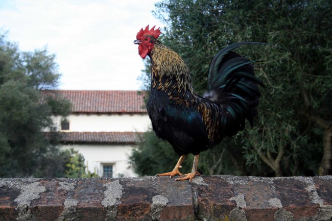
One block from the plaza is 3rd Street, the town’s main street. Lined by a collection of historic structures, including adobes dating back to the 1800’s, the street has many great restaurants and interesting shops.
The historic core of the town is pedestrian friendly and quiet. You may see chickens wandering the streets or cats sleeping beneath the pews in the mission church.
The cats are permanent residents of the mission and help to keep rodents from taking over.
Despite its size, San Juan Bautista has a busy calendar of annual community events, celebrations, and festivals.
These include annual arts and crafts festivals, car shows, art studio tours, food, music, and history events.
For a regularly updated schedule of events, go to http://www.sanjuanbautistaca.com/.
Students and children
The state park offers a “living history day” on the first Saturday of each month with costumed docents and events for children. 50 miles west of Los Banos on Highway 156, San Juan Bautista is a great place for a day trip or an easy stop on the way to Monterey Bay.
If you have a student in 4th grade who is studying California history, a trip to San Juan Bautista can bring it to life.
Nearby Fremont Peak State Park offers a campground, an observatory, and a relatively easy but exciting ½ mile hike to a summit with 360 degree views of the coast, Monterey Bay, and the surrounding mountains, hills, and valleys.

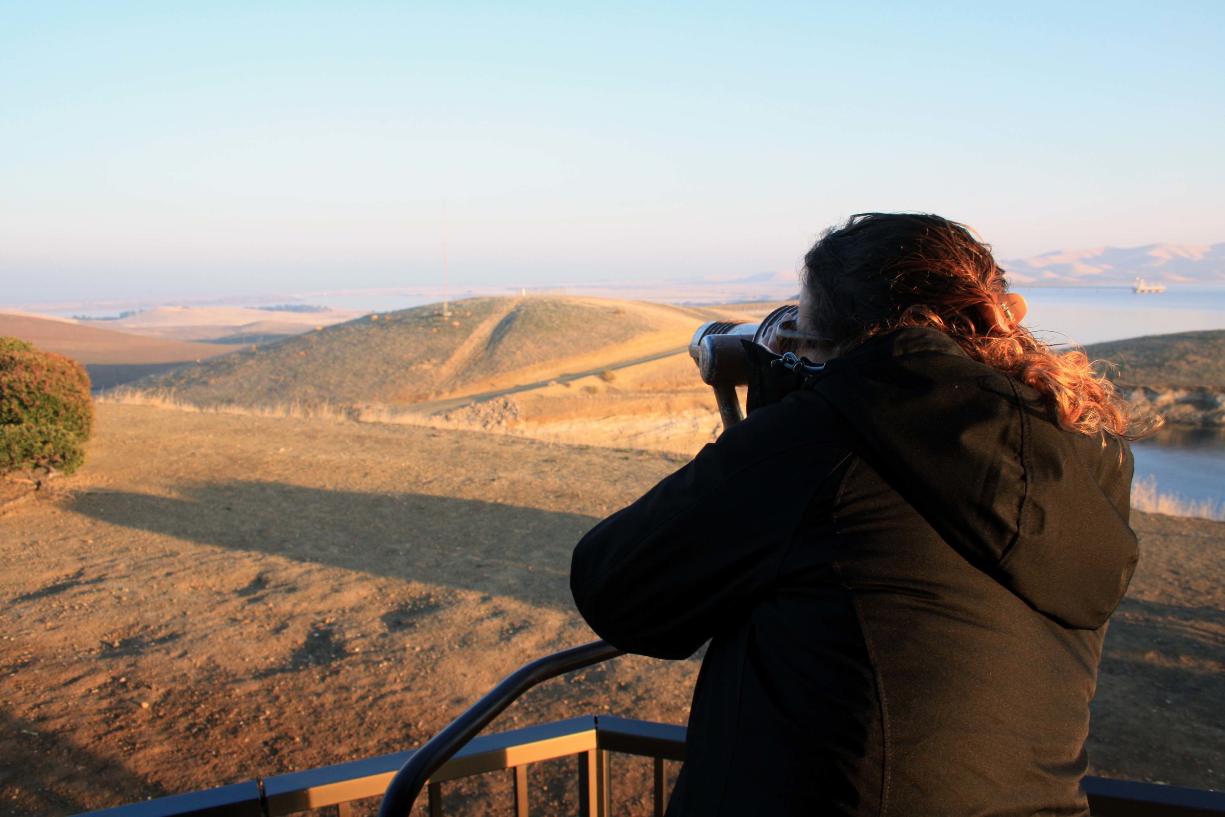
Romero Visitor Center – San Luis Reservoir

Photo by adam Blauert
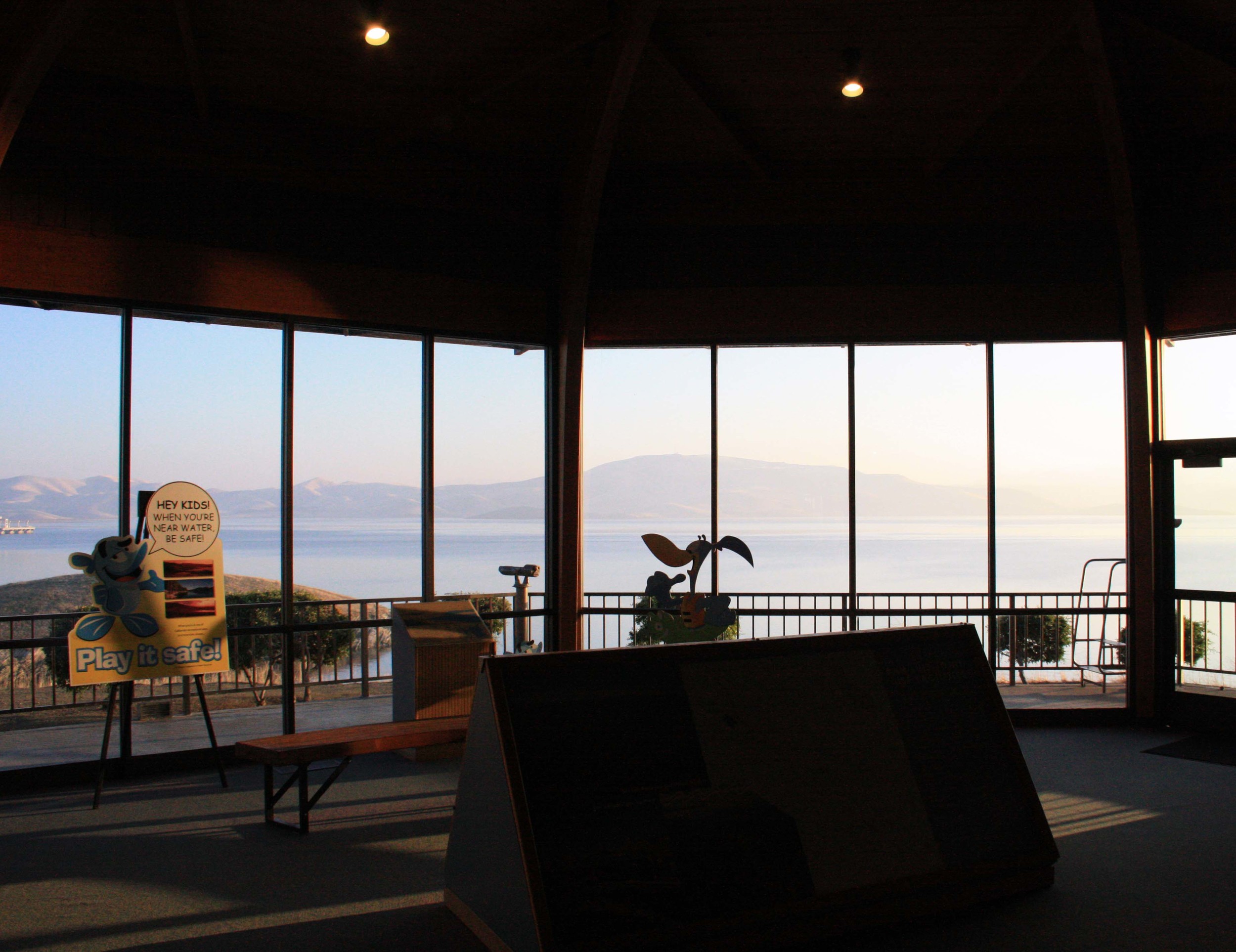
Romero Visitor Center – San Luis ReservoirDrivers heading out of Merced County over Pacheco Pass often notice the sign for the Romero Visitor Center at the San Luis State Recreation Area and wonder what it is.
For several years I did this – always on my way to get somewhere else. Finally last month I stopped to check it out.
Reservoir from Museum - PHOTO BY ADAM BLAUERT
Sisk Dam
Located at the top of the long span of Sisk Dam, the visitor center has exhibits about the history of the area, the construction of the dam, and California’s massive water storage and delivery system. Tours are available and a variety of films about water in California can be shown upon request.
If you’ve ever wanted to know more about water use and management in the Golden State, this is a great place to start.
Hours and cost
Open from 9AM to 5 PM daily (except major holidays), it is an easy and relatively quick stop on your way to somewhere else.
Better yet, admission is free. While you are there you can learn about recreational opportunities at the San Luis State Recreation Area and other recreation areas within the California State Water Project System from the Department of Water Resources guide on duty.

Exhibits - PHOTO BY ADAM BLAUERT
California Department of Water Resources
Although most of the visitor services within the San Luis SRA are operated by California State Parks, the Romero Visitor Center is operated by the California Department of Water Resources.
The reservoir was constructed between 1963 and 1967. Part of both the State Water Project and the Central Valley Project, the reservoir holds water from the Sacramento-San Joaquin River Delta before it is delivered throughout the state via the California Aqueduct and the Delta-Mendota Canal.
This redistribution of the state’s water is part of what makes modern California and possible. In a state where much of the land is desert (less than 10 inches of precipitation annually) or semiarid (less than 20 inches annually), water management is tremendously important to support a population of 38 million inhabitants, plus agriculture, industry, commerce, recreation, tourism, and wildlife.
Largest off-stream reservoir in the United States
385-foot tall rock and earthfill Sisk Dam forms the fifth-largest reservoir in California. Holding 652 billion gallons of water when full, the lake is only surpassed in size by Shasta, Oroville, Trinity, and New Melones.
It is also the largest off-stream reservoir in the United States.
Rather than stopping the flow of a river along its natural course, an off-stream reservoir holds water that has been pumped away from its natural location.
With this year’s worrisome dry winter, it’s a great time to increase your knowledge of this precious and scarce resource.
Although the reservoir is currently near full capacity after last year’s exceptional winter, it may soon be returning to the low levels that were so common a couple of years ago. Now is the time to enjoy the beauty of the reservoir.
For optimal viewing, pick a day with clear skies and clean air.
If we continue to get precipitation the hills may be very green by March and April. Great wildflower shows are common after wet winters.
Looking at the elk - PHOTO BY ADAM BLAUERT
Tule Elk
From the patio behind the visitor center, visitors can use free telescopes to view the lake and the surrounding hills.
If you’re lucky, the area’s herd of native tule elk may be within sight. On my recent visit they were grazing close to the dam.

Tule Elk - PHOTO BY ADAM BLAUERT
For more information
go to http://www.water.ca.gov/recreation/locations/sanluis/sanluisvisitor.cfm
or call (209) 827-5353.
Adam Blauert, a high school teacher and avid outdoors enthusiast, has dedicated the majority of his life to Merced County. His passions include fishing, backpacking, delving into local history, and exploring the wonders of the western states.