

Merced's Central Park: Applegate Park, Zoo & Kiddieland Merced

flag in park
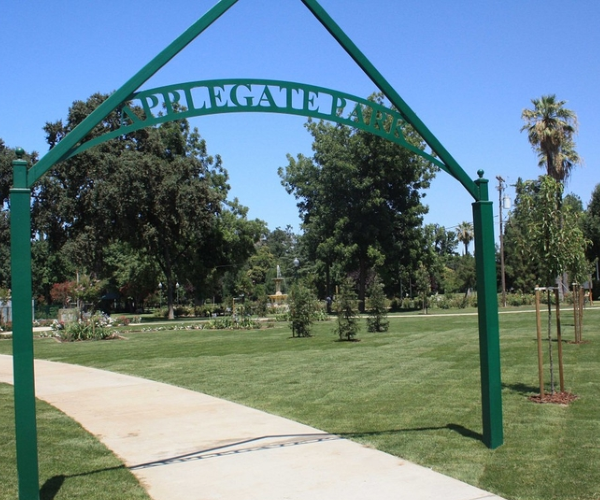
Applegate Park is Merced’s central park
Located along the Bear Creek Bikeway, the park is an excellent destination on bike or foot. It offers 32 acres of recreation with a zoo, outdoor theater, picnic tables, bbq grills, volleyball nets, tennis/basketball courts, a skate park, rental facilities, a large playground, a rose garden and fountain, and the Kiwanas-sponsored Kiddieland amusement park.
train
Plenty of parking is located around the park. Many community events are held at Applegate, including concerts and plays in the summer.

fountain
Location
Applegate Park is located along Bear Creek and the Bear Creek bikeway, between M and R Streets. The southern edge of the park follows 25th Street, P Street, and 26th Street.
Parking is available along the southern edge, N Street, and a parking lot on R Street near the Zoo.
applegate
Applegate Park Zoo
Merced Open Air Theater
Sports Facilities (Tennis, Basketball, Volleyball)
Skatepark
Playground
Fitness Equipment
Rental Facilities
playground

zoo 1
Applegate Park Zoo
The zoo specializes in local wildlife and activities for children, showcasing species native to the Central Valley and the foothills. From commonly-seen birds such as egrets and hawks to the elusive mountain lion, the zoo offers a cross-section of native wildlife.
Most of the animals have been relocated from wildlife rescue agencies.
Although owned by the City of Merced, the zoo is operated by the nonprofit Merced Zoological Society.

zoo 2
Friendly, trained volunteers are available to answer questions. This is a great place to get a close-up view of local species before heading out to a nearby wildlife refuge.

zoo 3
Hours and Admission
The zoo is open from 10-5 daily in the spring and summer and from 10-4 in the fall and winter, weather permitting. The zoo is closed on Thanksgiving, Christmas, and New Year’s Day.
For the latest Zoo hours and cost for admission, click here
Location
The zoo is located on R Street between Bear Creek and 25th Street. A parking lot is located on the corner of R and 25th.

goats
Activities
Petting Zoo and Goat Feeding: Friendly (and hungry) goats can be fed with goat food for sale at the zoo’s gift shop until the day’s supply runs out. Visitors who wish to feed the goats are advised to visit before 2PM.
The zoo also offers a small petting area where kids can play with chickens, rabbits, ducks, kittens, turtles and guinea pigs.
Field Trips: The Merced Zoological Society can arrange guided visits to the zoo for school groups.
Zoo Camp and Special Events: The zoo holds two one-week zoo camps for children aged 6 to 9 and a “Trick or Treat in the Zoo” on Halloween.
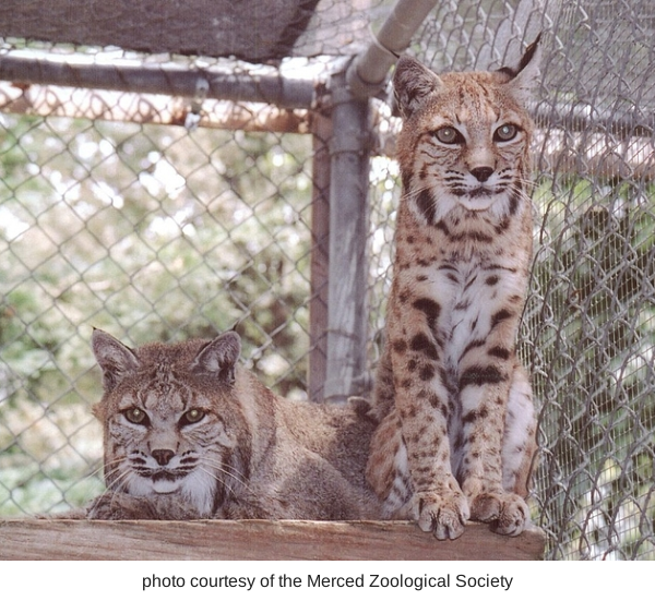
bobcats
Sometimes it is the "small animals" that are fun for the little ones!
This is a safe and fun option for families with small children. A storytime for kids aged 3-5 is offered every Saturday from 11-12. A number of other special events happen throughout the year.

savana
Birthday Parties
The zoo can be rented for birthday parties. Facilities include the Rossotti Ed-Zoo-Cation Center building with tables, chairs, refrigerator, freezer, and silverware. Table coverings, napkins, plates, cups, and invitations in an animal theme design are provided.
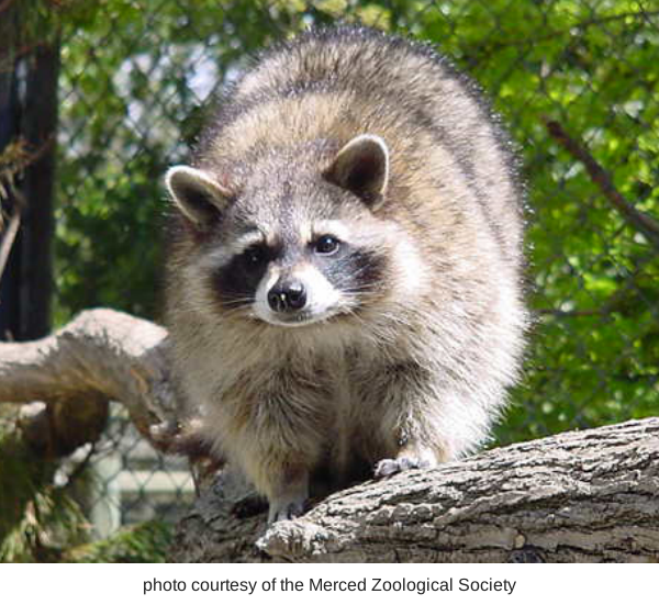
racoon
Zoo Parent Adoption Program
Groups can participate in the Zoo Parent Adoption Program which allows them to help feed and care for the zoo’s animals.
Gift Shop
The Zoological Society operates a gift shop that specializes in educational toys, books, and gifts. All proceeds help support the zoo’s operations.
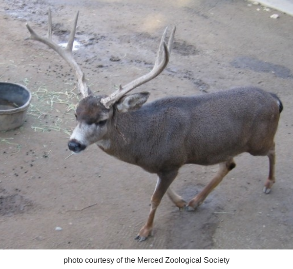
buck
Species
Mammals: black bear, mule deer, bobcat, raccoon, red fox, silver fox, opossum, goat, capuchin monkey
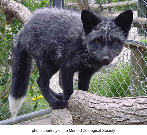
fox

screach owl
Birds: albino scrub jay, black crowned night heron, black swan, burrowing owl, cattle egret, emu, great egret, great snowy egret, green heron, great horned owl, harrier hawk,

owl
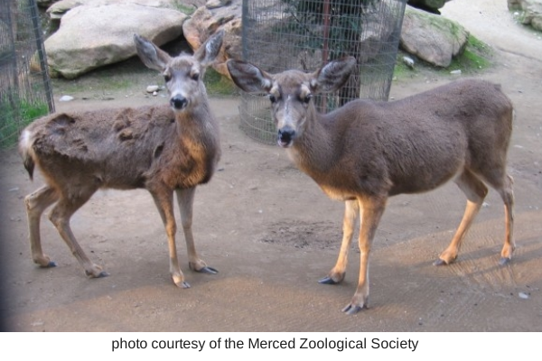
deer
ibis, kestrel, killdeer, magpie, northern flicker, peacock, raven, red tailed hawk, snowy egret, screech owl, Swainsons hawk, wild turkey, whistling (tundra) swan, wimberl, white faced ibis
Reptiles: tortoise, turtle
City of Merced- Applegate Zoo info (click here)
or contact the Merced Zoological Society at Mercedzoological@sbcglobal.net /
(209) 725-DEER (725-3337)
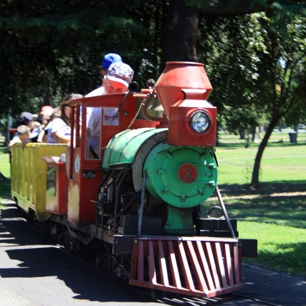
Kiddieland: Merced Kiwanis
Oporates the local Kiddieland amusement park since 1957. With six rides including a train that loops around Applegate Park, Kiddieland is a great place to take children on weekend afternoons.
Friendly Kiwanis volunteers operate the rides on Saturdays and Sundays from 1-5PM starting in March of each year.

Kiddieland 1
The amusement park remains open through October. Snacks are available at a refreshment booth. Kiddieland can be also be rented for private parties.
For more information about Kiddieland, click here
Location: Near the intersection of 25th and Q Streets.

Kiddieland 2
Additional information: Check out the Kiwanis webpage at http://greatermercedkiwanis.org/kiddieland Kiwanis is a worldwide volunteer organization whose motto is “serving the children of the world.”
Merced Open Air Theater
The most popular outdoor entertainment venue in Merced County, the Open Air Theater is the site of free concerts and plays throughout the summer. The theater can be rented for private events. Visit the City of Merced’s webpage for rental information: City of Merced Rental information.

Open Air Theater
Merced Shakespearefest stages Shakespeare plays at the Open Air Theater every summer. For more information go to: http://www.mercedshakespearefest.org/index.htm
Location: The theater is located in the middle of the park along the bikeway.
Sports Facilities
Volleyball nets are located in the eastern half of the park, between M and O Streets.
Tennis and basketball courts are located in the center of the park, near Kiddieland.
Skatepark: The skatepark is located in the center of the park, near O and 26th Streets.

Skatepark
Bikeway: Applegate Park is located along the Bear Creek Bikeway, which runs from McKee Road to Highway 59.
This route connects with other bikeways and bike lanes in Merced.
For a map, go to http://www.cityofmerced.org/documents/bikepathmap.pdf
Also check out our page titled Bike Paths in Merced County for additional bike routes throughout the county.
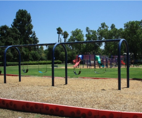
Playground: A large playground is located in the center of the park along 25th street between Q and P Streets. The playground includes swings, a large climbing structure with slides, and benches.
Rental Facilities: The Rossotti Ed-Zoo-Cation Center, Merced Open Air Theater, Scout Hut, Picnic Shelters, Gazebo and Rose Garden can all be rented for group events.
Visit the City of Merced’s webpage for rental costs and forms: City of Merced Rental information.

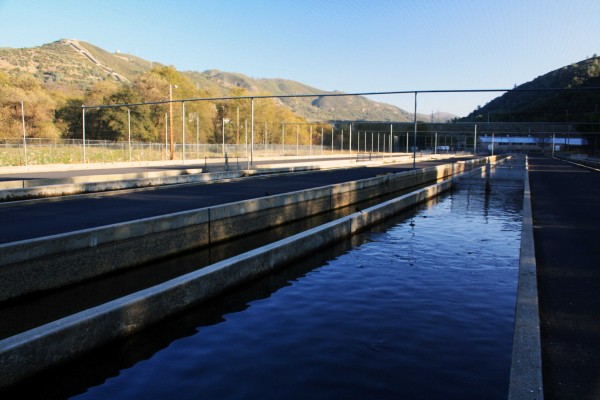
Moccasin Trout Hatchery
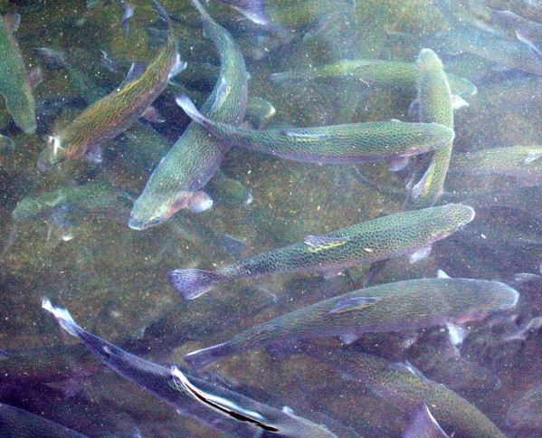
Photo by adam blauert
Fish and Game
In order to provide fishing opportunities for 38 million people, the California Department of Fish and Game grows trout and salmon in 21 hatcheries throughout the state and then stocks them in lakes and rivers to supplement the natural populations. Much of this is done by truck, however in roadless areas airplanes are used.
Large Trout - PHOTO BY ADAM BLAUERT
Moccasin hatchery
The closest trout hatchery to Merced County is located at Moccasin, along the northern route to Yosemite. For a map showing all of the DFG hatcheries in California, go to http://www.dfg.ca.gov/fish/Hatcheries/Moccasin/

Trout Swarming - PHOTO BY ADAM BLAUERT
Hours of operation
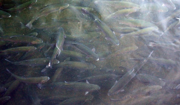
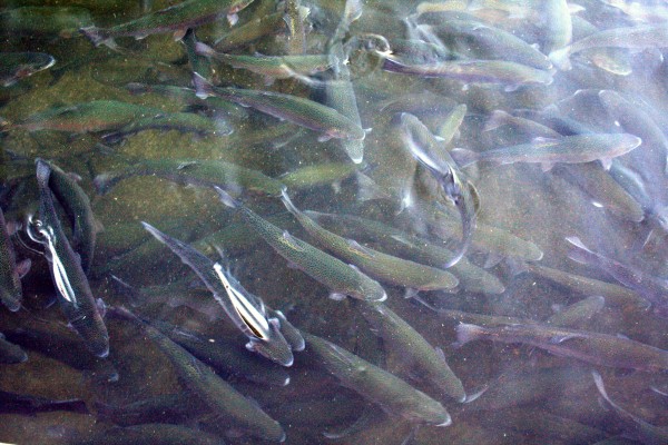
From 7:30AM to 3:30PM daily, visitors can observe and feed the rainbow trout at the Moccasin hatchery. The fish live and grow in long rectangular pools, protected from predators by a tall chain-link fence and overhead wires.
The largest fish – some of them very large – are located in a pool near the front of the hatchery. A sign indicates “show fish.”
Trout Jumping - PHOTO BY ADAM BLAUERT
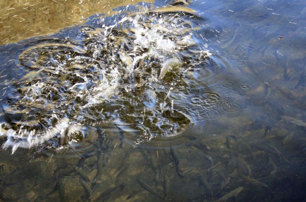
Bring quarters to feed the fish
Fish food is sold from a dispenser in the parking area. Bring quarters - $5 provided nearly an hour of fun the last time I visited. If you bring several children, more quarters may be necessary.
Tossing the food into the water creates a feeding frenzy. It is thrilling to watch swarms of beautiful fish jumping out of the water and moving great distances in the blink of an eye.
Large Trout - PHOTO BY ADAM BLAUERT
It’s great fun for all ages, especially for kids. The fish are conditioned to expect food from large vertical objects and a feeding frenzy may start when your shadow crosses the water, even if you don’t throw any food in.
In the winter months the surrounding mountains block the sun by 2PM. If you want to enjoy its warmth, arrive by noon.
Planning your visit
During the summer heat an early visit is recommended. Trying to catch jumping fish with your camera can be a lot of fun if you are a photographer. A polarizing filter is helpful to cut through the glare on the water.
The hatchery is located near the junction of Highways 120 and 49. If you come from the south via Highway 49, watch for a sign indicating a right hand turn for the hatchery just before you reach the Highway 120 junction. If you come from the west on 120, turn right on 49 and look for a signed left hand turn.
About 70 minutes from Merced, the hatchery is close to the historic towns of Coulterville, Chinese Camp, Big Oak Flat, and Groveland. It is also relatively close to Sonora, Jamestown, Columbia State Historic Park, and Railtown 1897 State Historic Park.
The BLM’s Red Hills Area is a great spot for a picnic or a hike in the fall, winter, or spring.
Red Hills is known for having an excellent wildflower display in March and April. If you are headed to or from Yosemite on Highway 120, the hatchery makes a convenient stop.
Hatchery - PHOTO BY ADAM BLAUERT
Hetch Hetchy
The buildings surrounding the hatchery pools are where fish are bred and hatched. The larger buildings and the pond beyond the hatchery complex are part of the Hetch Hetchy power generation system.
Water is diverted from the Tuolumne River through the large pipes that descend the mountains to the east of the hatchery (penstocks).
The great force of the descending water is turned into electrical power. In addition to providing electrical power, the Hetch Hetchy system supplies San Francisco with drinking water.
The diversion begins at the Hetch Hetchy Reservoir inside Yosemite National Park.
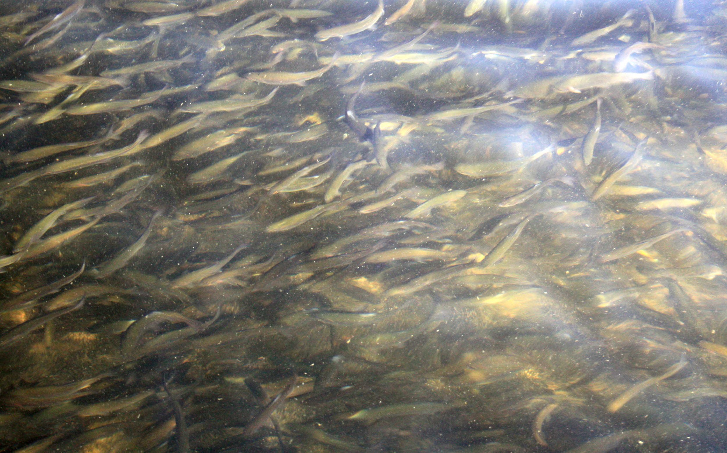
Medium Trout Underwater - PHOTO BY ADAM BLAUERT
Signs are posted warning hatchery visitors to stay off the concrete edges of the pools. Don’t feed the fish anything other than the food sold at the hatchery and don’t try to touch the fish.
To plan a school or group visit, contact the hatchery at http://www.dfg.ca.gov/fish/Hatcheries/Moccasin/


Yosemite – The Other Three Seasons

Photo by Adam Blauert
Yosemite National Park
The vast majority of Yosemite’s visitors arrive during the summer months. With comfortable weather, stunning waterfalls, kids out of school, and snow gone from roads, campgrounds, and trails, it’s not hard to guess why.
Summertime in Yosemite draws visitors from around the world – so many, in fact, that Yosemite Valley becomes one of the most international places in California.

Spring Yosemite Falls - Photo by Adam Blauert
It also becomes one of the most crowded. Despite the overwhelming popularity of the summer months, each season has surprises to offer.
Better yet, accommodations and parking are easier to obtain and the infamous traffic jams are virtually nonexistent during the fall, winter, and spring.
The park undergoes dramatic transitions between each season – fall leaves, winter snow, and the bright green of spring all offer beautiful surprises for visitors.
If you choose to visit in one of the “off” seasons, here are some of the special activities and sights that await you:
Fall: Autumn colors

Fall leaves: Quaking aspen groves in Lee Vining Canyon, just outside the park’s Tioga Pass Entrance turn bright yellow, gold, and orange from the middle to end of October. Oaks inYosemite Valley and Hetch Hetchy turn yellow orange towards the end of October.
Their leaves carpet the ground and often provide striking contrast to early snows. Dogwoods inYosemite Valley and the sequoia groves turn brilliant shades ranging from yellow to red about the same time.

Fall Early Snow Wawona Hotel - Photo by Adam Blauert
Trails and backpacking
Most trails remain open until the first major snowfall. After that they may be accessed on snowshoes or cross-country skis. Tuolumne Meadows and Glacier Point: No services are available in these areas, but the roads remain open until closed by snow. Backpacking is still an option if you are prepared with gear for cold weather. The lower elevations of the park make some of the best destinations. Overnight parking is prohibited on the Tioga Road after October 14th to lessen the danger of backpackers getting caught in early snows.
Golf in Wawona
The 9-hole course remains open until closed by winter weather.
For more information go to: http://www.yosemitepark.com/activities_golfing.aspx
Tire chains and emergency supplies
Make sure you pack them for fall travel as weather can be unpredictable!
Winter
Snow recreation
Downhill skiing and snowboarding: Badger Pass Ski Area has offered downhill skiing since the 1930’s.
Today it is a family-friendly place with slopes ranging from easy to challenging, equipment rentals, and lessons for all ages and abilities. http://www.yosemitepark.com/badgerpass.aspx

Winter Tunnel View - Photo by Adam Blauert
Ice skating
The Curry Village Ice Rink in Yosemite Valley has been a popular place to ice skate since 1928.
All ages enjoy the ice and skate rentals are available in all sizes. Ice skating is surprisingly affordable and most people find it far less difficult that they might expect.
For more information go to: http://www.yosemitepark.com/Activities_WinterActivities_IceSkatingRink.aspx
Snow play
Yosemite Valley and Crane Flat are great places for kids to play in the snow. At an elevation of6,000 feet, Crane Flat has more consistent snowfall.
Snowshoeing and cross-country skiing
Both of these forms of over-snow transportation provide fun recreation, exercise, and opportunities to get away from crowds. Snowshoes can be rented at Badger Pass, the Crane Flat Store, and the Curry Village Ice Rink (Yosemite Valley). Cross-country skis can be rented at Badger Pass.
Lessons and overnight group trips are available at Badger Pass.
For more information on snowshoeing go to: http://www.yosemitepark.com/BadgerPass_Snowshoeing.aspx
and for cross-country skiing go to: http://www.yosemitepark.com/BadgerPass_CrossCountrySkiing.aspx
The park maintains overnight accommodations at Glacier Point and Ostrander Lake for those ready to attempt a challenging trip. Popular day trips include visiting the Mariposa, Tuolumne, and Merced giant sequoia groves.
For maps and route information
See the website : http://www.nps.gov/yose/planyourvisit/wintersports.htm
Holiday events
The annual spectacle of the Bracebridge Dinner at the Ahwahnee Hotel recreates a joyous 17th century English Christmas.
Tickets must be applied for well in advance.

Yosemite
They become available from the park concessionaire one year and one day in advance beginning at 7AM: http://www.yosemitepark.com/SpecialEventsPackages_SpecialEvents_BracebridgeDinners.aspx
The Bracebridge Dinner is a lively pageant of song and entertainment in the Ahwahnee’s dining room accompanied by a delicious 7-course meal.

Winter Ahwahnee Hotel - Photo by Adam Blauert
The Ahwahnee and Wawona Hotels are both decked out Christmas every year.
Quiet time
Winter is a great time to stay in the park and enjoy solitude, snow, and crisp, starry nights.
Lodging and camping
Lodging and camping is available throughout the winter inYosemite Valley, and the Wawona Hotel is open through much of the winter.
Cabin rentals are available at Wawona, Foresta, and Yosemite West. Indoor lodging is preferable unless you have a lot of cold weather gear or an RV!
Hetch Hetchy
Open during daylight hours and is especially spectacular right after a snowstorm. Before making the trip, check with the park to make sure the road has been opened: (209) 372-0200.
Tire chains and emergency supplies
Tire chains are required in the park during the winter months and it is always a good idea to carry emergency survival supplies to cope with worst-case scenarios.
Spring
Green meadows, wildflowers in the lower elevations, and waterfalls as the weather warms, the snow melts and the waterfalls begin to become truly spectacular.
Trails
The snowmelt also begins to reopen trails to regular foot traffic and roads to car traffic. Yosemite Valley, Hetch Hetchy, and Wawona melt off first. The road to the Mariposa Grove of Big Trees often opens in late March or early April.
If it isn’t open, you can walk the two miles that remain closed. Waterproof boots or snowshoes may be appropriate, depending how much snow is on the ground. The Glacier Point road often opens in May.
Check with the park to determine which roads and trails are open: (209) 372-0200.
Backpacking
As trails reopen, backpacking trips become possible in the lower elevations.
Wildflowers
The wildflower show starts at the lowest elevations, especially along theMerced RiverCanyon in the El Portal area.
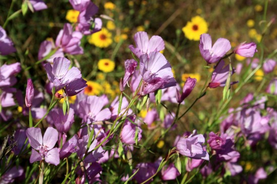
Spring El Portal Wildflowers - Photo by Adam Blauert
This area is often good in April. Through late April and early MayYosemite Valley and Hetch Hetchy start to green up. The wildflower show continues throughout the summer in the highest elevations.
The Wawona Golf Course
The golf course reopens after snow has left the meadow.
For more information go to: http://www.yosemitepark.com/activities_golfing.aspxTire chains and emergency supplies:Keep carrying them into the spring. Late snowstorms are always possible!

Spring Late Snowmelt Hetch Hetchy Trail - Photo by Adam Blauert
Every season and activity involves different kinds of risks. Before trying anything new, make sure you are aware of potential dangers and are prepared with the necessary skills and knowledge to avoid them.
Tips that will help you avoid crowds and related problems
- Avoid holiday weekends.
- Arrive early, find parking, and then use the free shuttle to get around the park.
- Try visiting less crowded (but not less spectacular) areas of the park that outside of Yosemite Valley.
- Wawona, Tuolumne Meadows, the Mariposa Grove of Big Trees, and Hetch Hetchy can all be excellent choices.
- Try to visit midweek during the summer.
- Get out and hike! Pick less popular trails. MirrorLake, the Mist Trail, LowerYosemiteFalls, and the trails on the floor of Yosemite Valley tend to be the most crowded.
A guidebook can help you find some of the ones that see fewer visitors.

My favorite is Jeffrey P. Schaffer’s Top Trails: Yosemite: Must-Do Hikes for Everyone this is because it covers just about every mile of trail in the park, but because it also points out a lot of alternatives including unofficial cross-country and “use” routes to infrequently visited spots.
Yosemite National Park Daily Traffic Forecast : http://www.nps.gov/yose/planyourvisit/traffic.htm

Merced County Wildlife Refuges

photo by adam blauert
Merced County Wildlife Refuges
Most of the acreage is managed by the U.S. Fish and Wildlife Service, with additional areas under the jurisdiction of the California Department of Fish and Game.
Recommended areas to visit
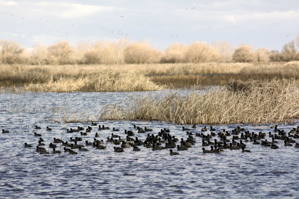
Merced Wildlife Refuge - PHOTO BY ADAM BLAUERT
Merced National Wildlife Refuge
Merced Unit: Auto tour, hiking trails, viewing platforms
San Luis Refuge - PHOTO BY ADAM BLAUERT
San Luis National Wildlife Refuge
San Luis Unit: Elk and waterfowl auto tours, hiking trails, viewing platforms, visitor center.

San Luis Refuge - PHOTO BY ADAM BLAUERT
San Luis National Wildlife Refuge Complex
The largest unit is the San Luis National Wildlife Refuge Complex, which is made up of several individual units including the Merced National Wildlife Refuge and the San Luis National Wildlife Refuge.
Much of this area is open to the public for a variety of recreational uses.
Tule Elk
In addition to the many avian species, a herd of magnificent tule elk can be viewed in the San Luis Unit on Wolfsen Road north of Los Banos. Once hunted nearly to extinction, stable populations now live in several areas throughout the state.

San Luis Refuge - PHOTO BY ADAM BLAUERT
Birds
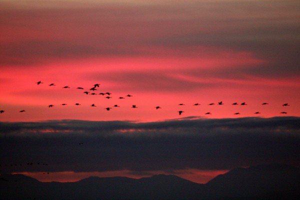
The refuge complex is located along the Pacific Flyway, an important migration corridor for dozens of species of waterfowl and other birds.
Some of the most common include Ross’ geese, Aleutian cackling geese, snow geese, green-winged teal, mallard, northern pintail, gadwall, American wigeon, northern shoveler, and white-fronted geese.
The refuge complex constitutes the largest contiguous freshwater wetlands remaining in California.
While wildlife can be viewed throughout the entire year, the wintering populations of lesser Sandhill cranes and Ross’ geese are a highlight. They arrive in the fall and stay until about mid-April, eventually returning to their summer homes in Alaska and Canada.

San Luis Refuge - PHOTO BY ADAM BLAUERT
Some remain throughout the summer and use the area as a breeding ground. During the foggy winter months, afternoon is usually the best time to visit.
In addition to wetlands, vernal pool and upland habitat also abound in the refuge. As the ground dries out in the spring, a brilliant wildflower show occurs in the vernal pool regions.
Visitor Center

Interpretive displays and group programs will be offered. Special tours and programs can be arranged for schools, clubs, and other organizations. For information about the new visitor center click here.
Useful websites for the San Luis Wildlife Refuge Complex
San Luis NWR main website: http://www.fws.gov/sanluis/default.htm
Each refuge area with public access is described below with its principal recreational features and facilities. Check each individual area for specific rules regarding hunting and fishing.
Catfish and bass are the most common fish species. Hunting regulations and types of game vary by area, but can include all waterfowl and upland game birds, deer, and wild pigs. Horses are not permitted.
For additional information, use the web links to access resources provided by the U.S. Fish and Wildlife Service and the California Department of Fish and Game.
Merced National Wildlife Refuge - Merced Unit
The main unit of the Merced NWR is open to both auto touring and hiking on three designated trails. Only a few miles from Merced, this is a great place to spend an afternoon in the fall, winter, or spring.
Location: Sandy Mush Road, west of Highway 59.
Activities and Facilities:
Wildlife viewing
Auto tour route – 5.2 mile auto tour route circles the heart of the refuge with four viewpoints, two observation decks and access to three hiking trails. Visitors are asked to remain in their vehicles except at these points.
Hiking trails
Meadowlark Trail – 1.5 mile loop
Kestrel Trail - .5 mile loop
Bittern Marsh Trail - .6 mile loop
Hunting
Restrooms
A photo blind is available for nature photographers by obtaining a special use permit. Vernal pools can be observed north of Sandy Mush Road. Pets are allowed as long as they remain in vehicles. No fishing is allowed in this refuge area.
Merced National Wildlife Refuge – Lone Tree Unit
This area is only open to hunting.
Location: Sandy Mush Road, west of Highway 59. Adjacent to Merced Unit.
Activities and Facilities
Hunting
San Luis National Wildlife Refuge – Blue Goose Unit
This area is only open to hunting.
Location: Highway 140, east of Gustine. Adjacent to Kesterton Unit.
Activities and Facilities:
Hunting
San Luis National Wildlife Refuge – Freitas Unit
This area is only open to hunting.
Location: Highway 140, east of Gustine. Adjacent to Kesterton Unit.
Activities and Facilities:
Hunting
San Luis National Wildlife Refuge - Kesterson Unit
In the late 1980’s, the selenium-contaminated Kesterton Reservoir was drained, decontaminated, and redeveloped as an addition to the San Luis NWR. It now provides over ten miles of unsigned hiking trails and great opportunities to view wildlife.
Trails are not marked, but visitors are welcome to wander around outside of hunting season.
Location: Highway 140, east of Gustine
Activities and Facilities:
Wildlife viewing
Hiking trails: Kesterton contains a network of over 10 miles of interconnected nature trails. These trails are open from February 15 – September 15.
Hunting
San Luis National Wildlife Refuge - San Luis Unit
This part of the SLNWR offers the widest range of activities. Two auto tour routes and three hiking trails give visitors a chance to observe tule elk and many bird species. The new visitor center is now open. The new visitor center provides an opportunity to learn more about the refuge and its inhabitants.
Location: Wolfsen Road, north of Los Banos.
Activities and Facilities:
Wildlife viewing
Auto tour route
Elk Tour Route – 5 miles
Wetlands and Waterfowl Tour Route – 12 miles
Visitor center
Dogs allowed
Hiking trails
Sousa Trail – 1.2 miles to an observation platform and telescope
Chester Trail – 1 mile (Open February 15 – September 15) This trail leads to the San Joaquin River and the site of Chester, an early settlement in Merced County.
Winton Marsh Trail - .7 mile to an observation platform and benches
Hunting
Fishing – a special access road on the west side of the elk enclosure provides access to all fishing areas.
Restrooms
Drinking fountains
San Luis National Wildlife Refuge - West Bear Creek Unit
This area offers hiking trails and an auto tour route. It receives less visitation than other parts of the San Luis NWR.

San Luis NWR - PHOTO BY ADAM BLAUERT
Location: Highway 165 (Lander Avenue), north of Los Banos
Activities and Facilities
Wildlife viewing
Auto tour route: 2 ¼ mile route around a large wetlands slightly west of the San Joaquin River with two viewpoints.
Hiking trails:
Woody Pond Trail – approximately 1.5 mile loop trail with viewpoint
Raccoon Marsh Trail – approximately 1 mile loop trail with viewpoint
Hunting
Restrooms
Wildlife Refuges Operated by the California Department of Fish and Game
In addition to the 128000 acres managed by the US Fish & Wildlife Service, another 24,000 acres are managed by the California Department of Fish and Game. These include:
Cottonwood Creek Wildlife Area
Los Banos Wildlife Area
North Grasslands Wildlife Area
O’Neill Forebay Wildlife Area
San Luis Reservoir Wildlife Area
Volta Wildlife Area
West Hilmar Wildlife Area
State Wildlife Refuges Map: http://www.dfg.ca.gov/lands/wa/region4/docs/LosBanosGrasslandsVoltaWA.pdf
"Each refuge area with public access is described below with its principal recreational features and facilities. Check each individual area for specific rules regarding hunting and fishing.
Catfish and bass are the most common fish species. Hunting regulations and types of game vary by area, but can include all waterfowl and upland game birds, deer, and wild pigs.
Horses are not permitted. Hiking biking are allowed from the end of the second week in February through September. Bicycles may be ridden on levee roads.
Dogs are permitted and may be off leash from June 6 through the end of March. Drawdown of the waters within the refuges usually takes place in spring and the refuges remain largely dry until the late fall.
For additional information, use the web links to access resources provided by the U.S. Fish and Wildlife Service and the California Department of Fish and Game.”
Cottonwood Creek Wildlife Area
Location: Western edge of Merced County, northeast of Highway 152
Activities:
Wildlife viewing
Hunting
Website: http://www.dfg.ca.gov/lands/wa/region4/cottonwoodcreek.html
Los Banos Wildlife Area
Location: Northeast of Los Banos on Henry Miller Avenue
Fishing and kayaking are allowed on Buttonwillow and Ruth Lakes. Catfish and crappie are the most commonly caught fish species.
Activities and Facilities:
Wildlife viewing
Hunting
Fishing
Boat launch
Restrooms
Drinking fountains
No designated trails, but foot and bike access is allowed throughout the area.
Website: http://www.dfg.ca.gov/lands/wa/region4/losbanos.html
North Grasslands Wildlife Area
China Island Unit: Brazo Road, northeast of Highway 33, between Gustine and Newman
Gadwall Unit: Santa Fe Grade Road, east of Los Banos
Salt Slough Unit: North of Los Banos on Highway 165 (Lander Avenue)
Activities and Facilities:
Wildlife viewing
Hunting
Fishing
Boat launch
Website: http://www.dfg.ca.gov/lands/wa/region4/northgrasslands.html
O’Neill Forebay Wildlife Area
Location: Highway 33, just north of Highway 152. Adjacent to San Luis State Recreation Area.
Activities and Facilities:
Wildlife viewing
Hunting
Restrooms
Website: http://www.dfg.ca.gov/lands/wa/region4/oneillforebay.html
San Luis Reservoir Wildlife Area
Activities and Facilities: South of Highway 152 at Dinosaur Point Road. Adjacent to San Luis State Recreation Area, Pacheco State Park and Upper Cottonwood Creek Wildlife Area.
Wildlife viewing
Hunting
Restrooms
Website: http://www.dfg.ca.gov/lands/wa/region4/sanluisreservoir.html
Volta Wildlife Area
Location: Ingomar Grade Road, northwest of Los Banos.
Activities and Facilities:
Wildlife viewing
Hunting
Website: http://www.dfg.ca.gov/lands/wa/region4/volta.html
West Hilmar Wildlife Area
Location: Four miles south of Hills Ferry on the east side of the San Joaquin River.. Accessible only by boat.
Activities and Facilities:
Wildlife viewing
Hunting
Website: http://www.dfg.ca.gov/lands/wa/region4/wes
Western Merced County boasts over 152,000 acres of wildlife refuges and conservation easements. Making up over 12% of the county’s total land area, these refuges are home to tule elk and a wide range of migratory birds.
Popular for wildlife viewing and hunting, the refuges also offer auto tour routes, hiking trails, and viewing platforms with telescopes.
Fishing is allowed in many areas. Access to all areas is free.
Adam Blauert, a high school teacher and avid outdoors enthusiast, has dedicated the majority of his life to Merced County. His passions include fishing, backpacking, delving into local history, and exploring the wonders of the western states.